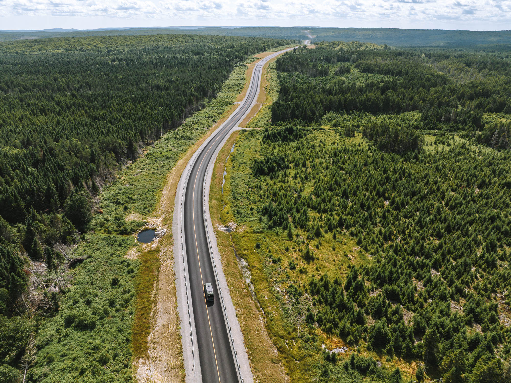
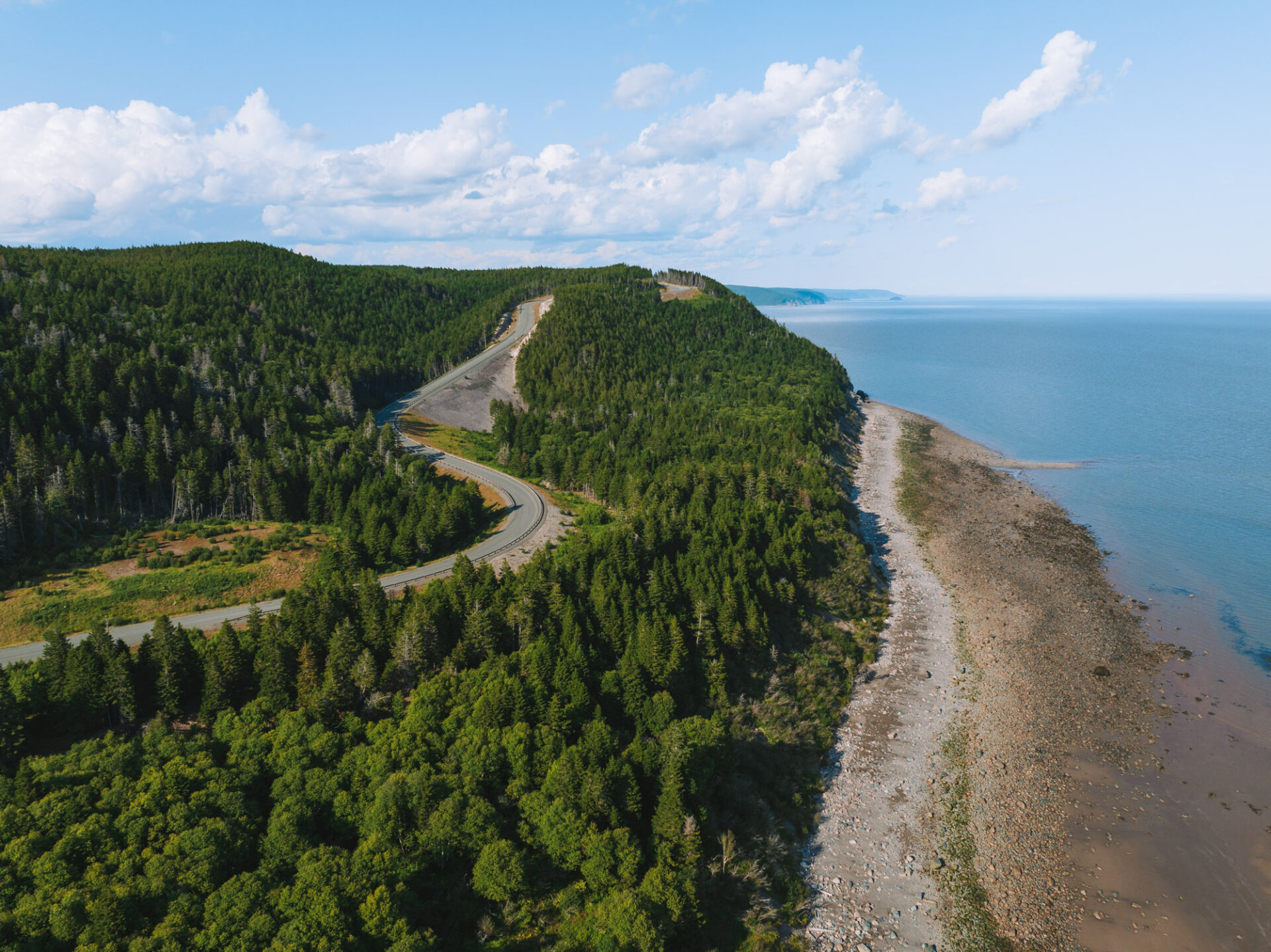
Fundy Trail Parkway is a fascinating ecosystem showcasing the unspoiled beauty of the Bay of Fundy coast. The drive along the Fundy Trail Parkway offers plenty of attractions including the world’s highest tides, over 35 km (22 miles) of biking and hiking trails, over 20 scenic lookouts, pristine beaches, a 15-metre waterfall, a 60-metre suspension bridge, a canyon and 600 million-year-old rock formations.
*This post may contain affiliate links, as a result, we may receive a small commission (at no extra cost to you) on any bookings/purchases you make through the links in this post. As an Amazon Associate, we earn from qualifying purchases. Read our full disclosure
Having completed the Fundy Trail Parkway drive on our recent Atlantic Canada road trip, we have put together the ultimate guide to the Fundy Trail Parkway including the best stops along the way to help the whole family make the most of your trip!
Traveling Soon? Here is a list of our favourite travel providers and accessories to help get you ready for your upcoming trip!
How To Get To Fundy Trail Parkway
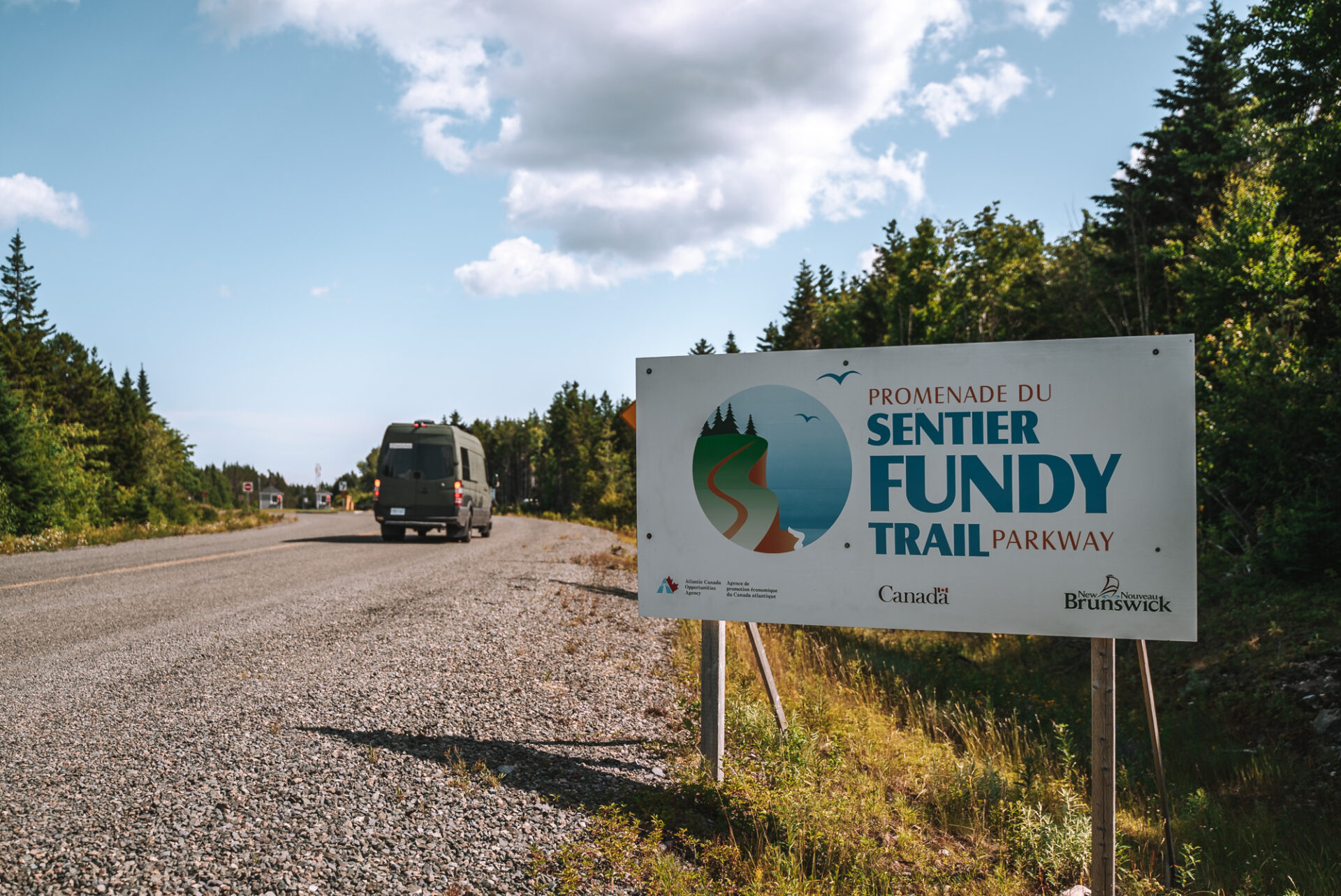
The Fundy Trail Parkway stretches along the Bay of Fundy coast in southern New Brunswick, between the towns of St Martin’s and Alma. Part of the Trans Canada Trail, the gated park has two entrances and is accessible either from the west or from the east side.
St Martin’s – Western Entrance
From Highway 1, take exit 198 for New Brunswick 111/New Brunswick 114 toward Sussex/Sussex Corner/Saint Martins. Follow NB-111 W (follow signs for Sussex Corner/Saint Martins/Fundy Trail). Take your next right onto Post Road to continue following NB 111 W for approximately 2.5 km (1.5 miles). Turn left onto Needle Street to continue following NB 111 W. After about 500m (1640 ft) on Needle Street, you turn right and travel through the village of St. Martins and to the western end of the Fundy Trail.
Alma – Eastern Entrance
Leave Moncton and travel toward Alma on NB Route 114 S. Travel the Fundy Coastal Drive from Moncton through the Villages of Hillsborough, Hopewell Cape, and Riverside-Albert before reaching Alma. Continue following NB Route 114 W through Fundy National Park. Turn left onto Shepody Road immediately after exiting the park boundary. Turn left onto Little Salmon River Road at the end of Shepody Road after about 16.5 km (10.2 miles). After another 11 km (6.8 miles), you will arrive at the destination’s east gate.
As you turn off NR Route 114, you’ll notice that Shepody Rd has been recently paved, allowing for easy paved access to the Fundy Trail Parkway via Little Salmon River. It’s a great way to road trip to the Fundy Trail Parkway from Moncton, visiting Hopewell Rocks and Fundy National Park along the way.
FAQs:
How Long Is Fundy Trail Parkway?
It is a 2,559 hectare (6,323 acre) park featuring a 30 km (19 miles) parkway. There is also the 64.3 km(39.9 miles) Fundy Footpath hike that is separate from the Parkway, although part of it does fall within the Park.
When Is Fundy Trail Parkway Open?
The Park operates every year from Mid May to Mid October and is closed during the winter months.
The visiting hours are from sunrise to sunset, so actual hours vary depending on the time of year. Check the Fundy Trail Parkway hours on the official website to find out exactly how much time you have to enjoy the Fundy Parkway.
The rates are $11.50 per adult, with discounts available for youth, seniors, families, and groups.
Is The Fundy Trail Parkway Paved?
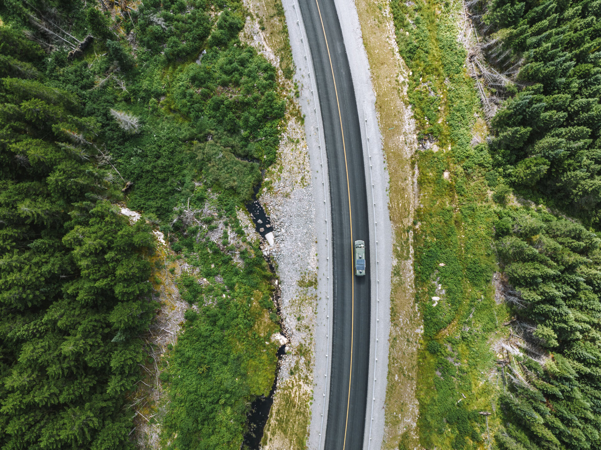
Yes. This famous destination is fully paved and accessible by any vehicle. You could even bike the parkway if you wanted. Additional hiking and biking trails are scattered all around the park, including the 10km unpaved, moderately challenging multi-use trail.
Where Does The Fundy Trail Parkway End?
If traveling from East to West, the Fundy Trail Parkway will end in the town of St Martin en route to Saint John. However, we recommend travelling on the Fundy Trail Parkway from West to East as all lookout points will be on the right-hand side and easier to make. There are also more activities and things to do in the west part of the Parkway, so you can tackle them while you still have lots of energy. In this case, the endpoint of the Fundy Trail Parkway will be just outside of Walton Glen Gorge.
How Much Time Do You Need To Visit Fundy Trail Parkway?
The time to drive from one gate to another within the speed limit is about 45 minutes, but we recommend spending a minimum of 2-3 hours en route.
Got more time? Even better! Plan to spend the whole day exploring the Fundy Trail Parkway and make the most out of your entrance ticket.
NOTE: Facilities along the Fundy Trail Parkway are limited. There are no restaurants, cafes or shops along the way, so pack your lunch or plan ahead and order a Lumberjack Picnic which can be picked up at the Cookhouse inside the park between 11:00 am and 1:00 pm. The Lumberjack Picnic Lunch must be booked at least 48 hours in advance.
Best Stops Along The Fundy Trail Parkway
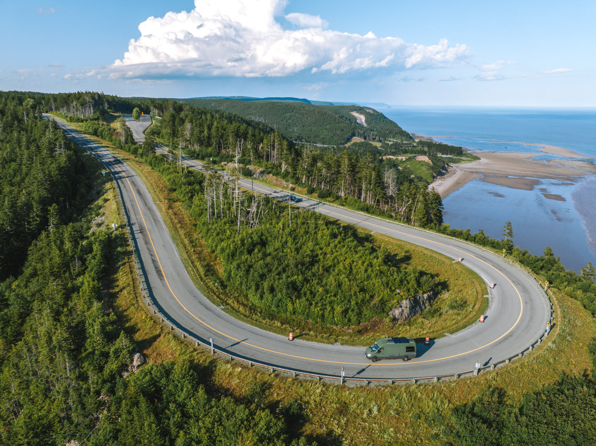
The Fundy Trail Parkway spans 30kms with a division of three main sections: Western, Central and Eastern. Below is the list of our favourite stops and lookouts in each section.
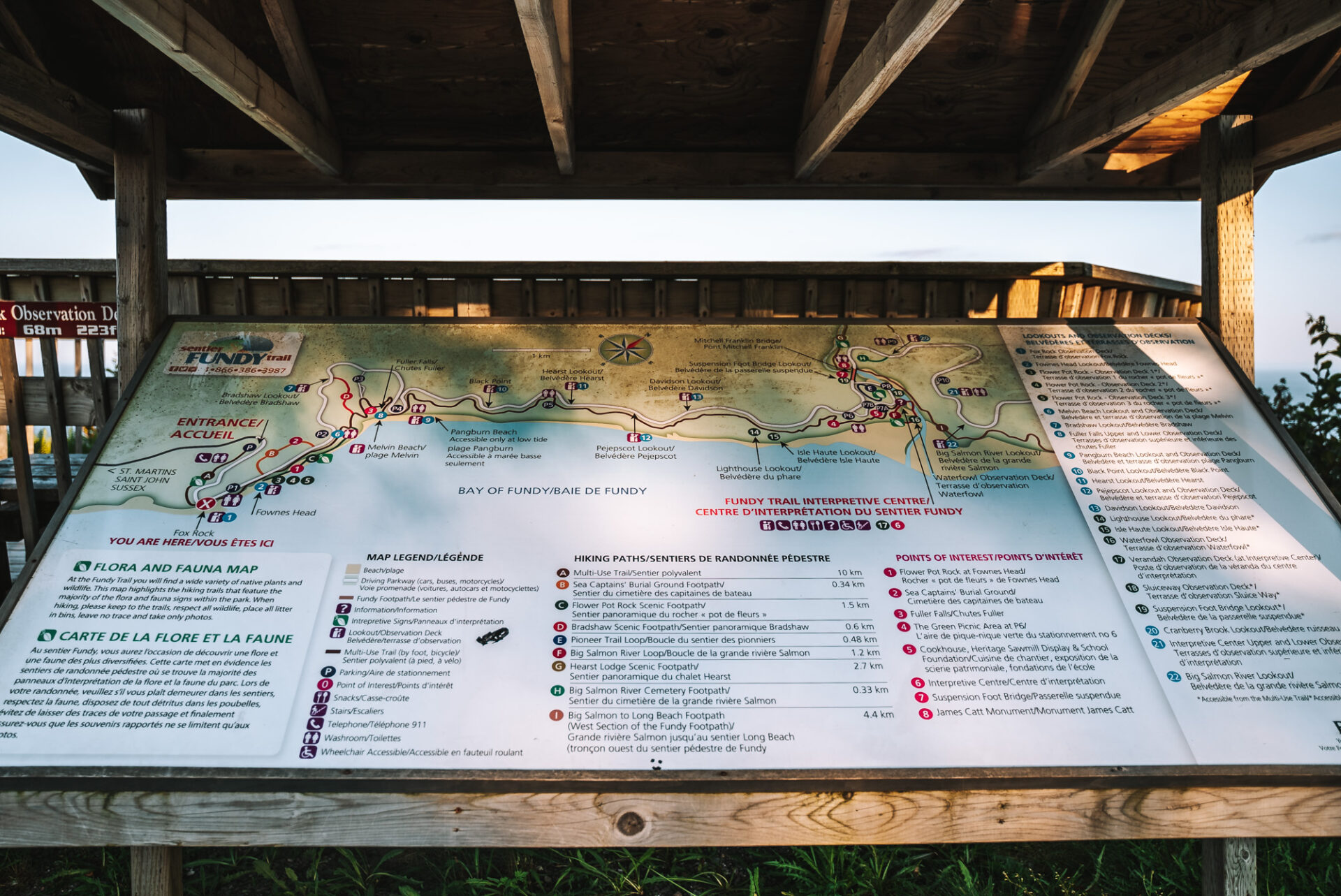
Western Section
The Western section of the park begins at the West Gate, near the town of St Martins. The main attractions in this area include coastal cliffs, rock formations, lookouts, and scenic hiking paths.
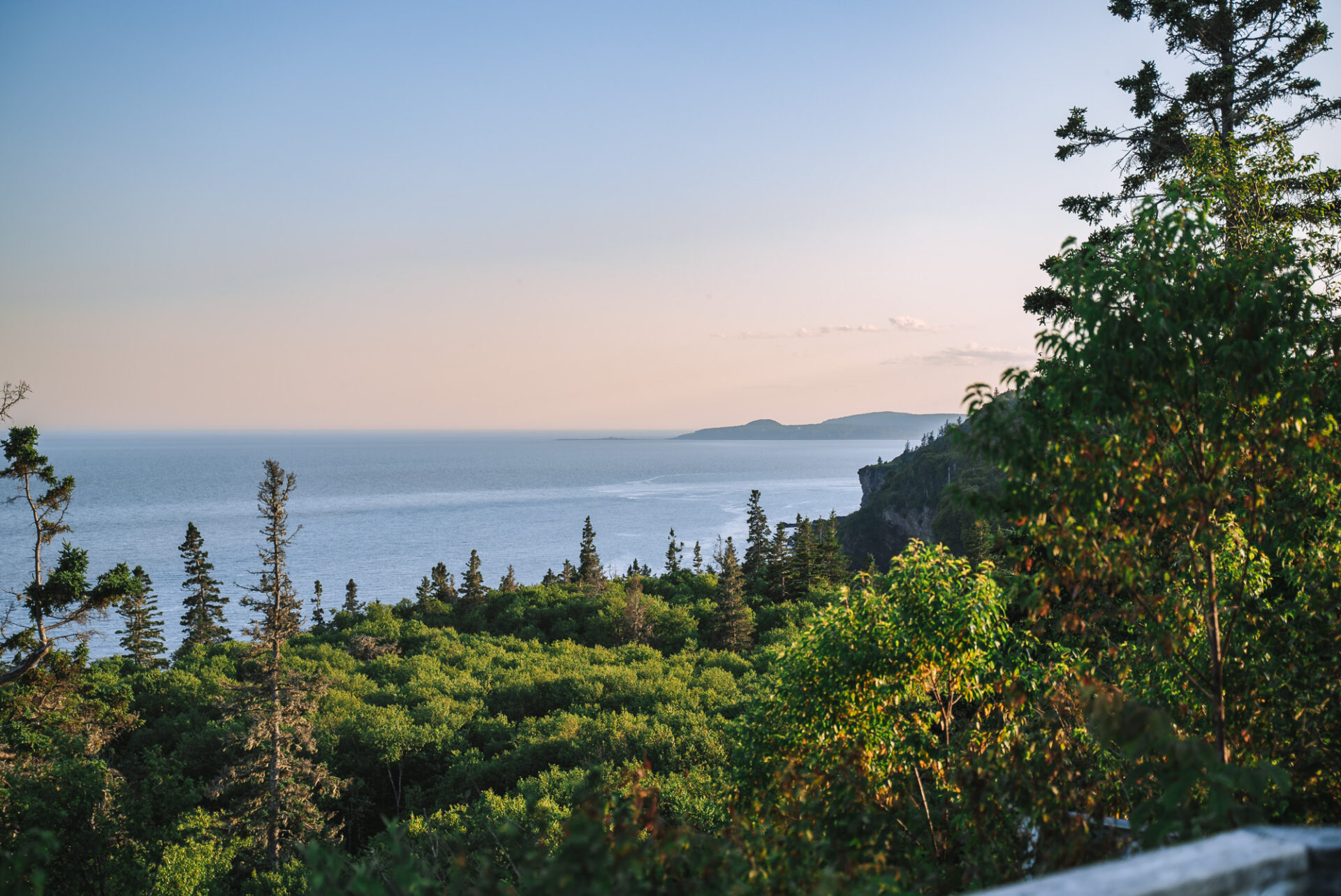
Fox Rock Lookout – The first lookout of Fundy Trail Parkway does not disappoint. It offers an excellent vantage point of Isle Haute, “High Island,” with its dramatic high rocky cliffs and views all the way to Quaco Head Lighthouse. Catch the first glimpse of the spectacular Bay of Fundy and get excited for the journey ahead.
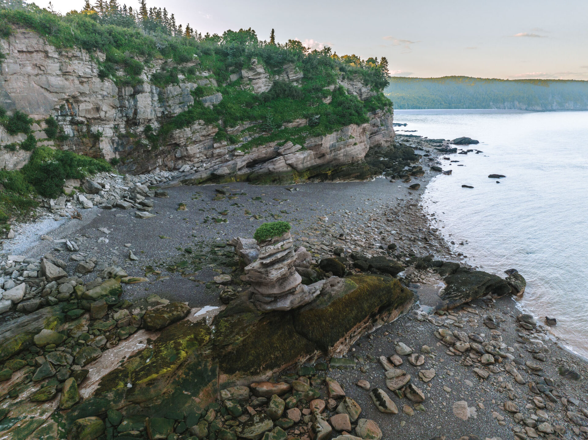
Flowerpot Rock at Fownes Head – A result of the coastal erosion process, the Flowerpot Rock is a unique rock formation named after the tuft of vegetation that grows on its tops. You can admire the Flowerpot Rock from one of the observation decks or follow the Flowerpot Scenic trail to see the rock up close.
Flowerpot Rock Scenic Footpath – This trail leading to Flowerpot Rock is a moderate-difficulty hiking trail of 1.5 km (0.9 miles) starting from the Fownes Head Lookout. Terrain can be muddy and rocky, so appropriate footwear is a must. Note that the trail may not be accessible during high tide.
Melvin Beach Lookout– Worthy stop to view the clay-coloured cliffs between Melvin and Pangburn Beaches. If you want to go down the wooden steps toward the Fundy coastline, make sure to check the tide schedule, as it is only accessible at low tide.
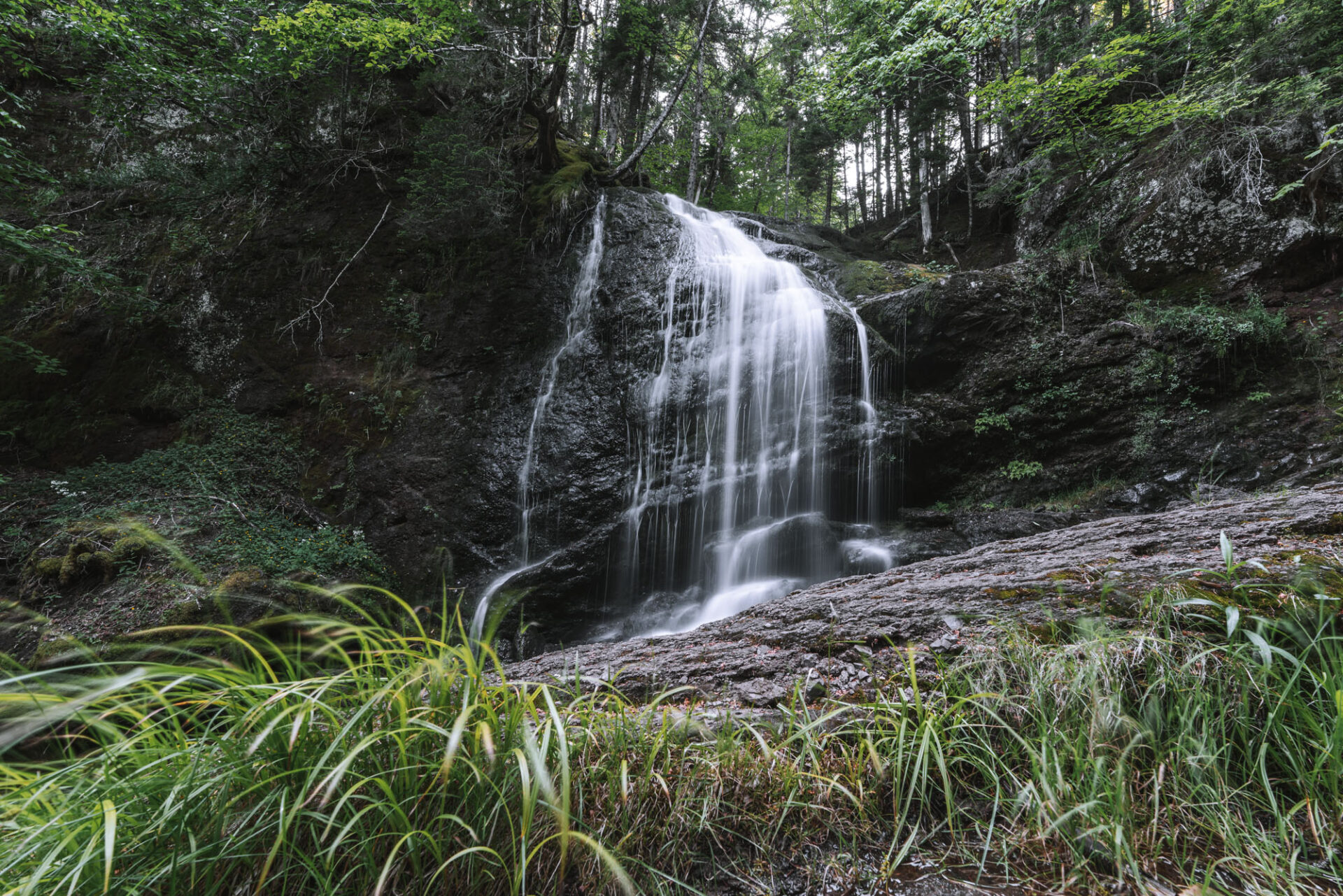
Fuller Falls – One of the top attractions of this famous destination, the waterfall is easy to reach from the parkway. It’s the most impressive of all the waterfalls on the Fundy Parkway trail.
Bradshaw Scenic Footpath – This is a moderate to strenuous, 0.6 km (0.3 miles) short hike, starting from the Bradshaw lookout and ending at Fuller Brook walking bridge.
St. Martin’s Sea Caves – These amazing sea caves can be reached on foot during low tide, and it’s best to wear water shoes because your feet will get wet, and it’s a bit rocky to go barefoot. The short trail to the caves starts at the parking lot next to The Caves Restaurant.
Explore the Village of St. Martins – Established in 1783, the picturesque village of St. Martins was once a shipbuilding capital, ranking as the second-largest producer of wooden sailing vessels in New Brunswick. For a bit of history about this area, you can pop into the Quaco Museum & Library as you wander through the village. There are also some lovely artisan boutiques and galleries in town.
Vaughan Creek Covered Bridge and Hardscrabble Covered Bridge – Stop for some photos at these historic covered bridges. They have been restored over the years and are still in use today.
Other Lookouts: There are many lookout points on this stretch of the parkway. Many offer similar coastline views but are lovely to check nonetheless. They include:
- Pangburn Beach Lookout
- Black Point Lookout
- Hearst Lookout
- Pejepcot Lookout
- Davidson lookout
Central Section
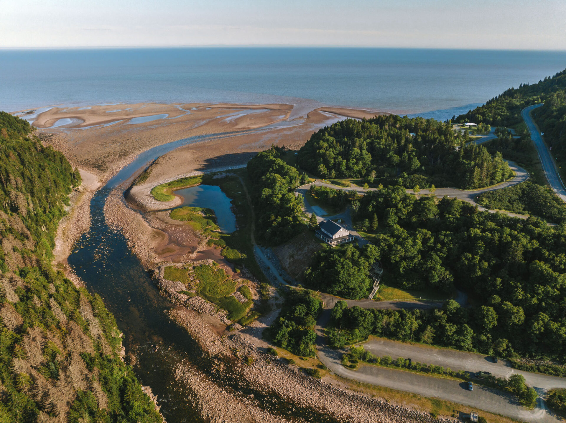
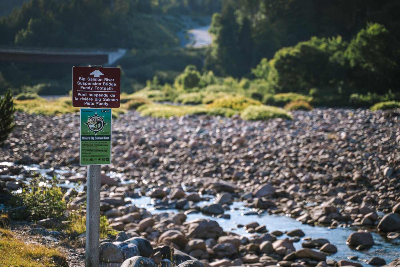
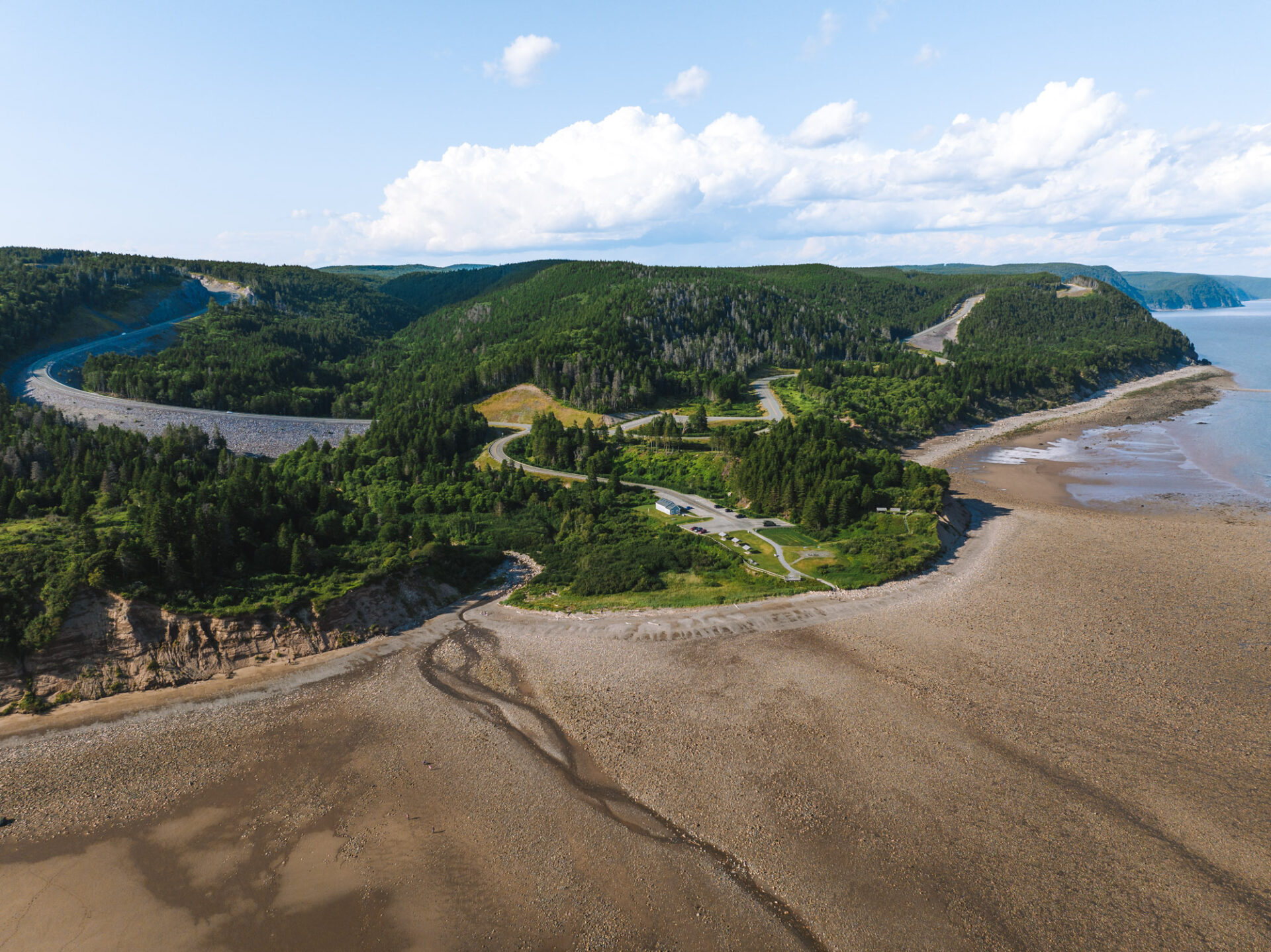
The Central Section is located at the mouth of the Big Salmon River and features popular attractions, including the suspension footbridge and beautiful Long Beach.
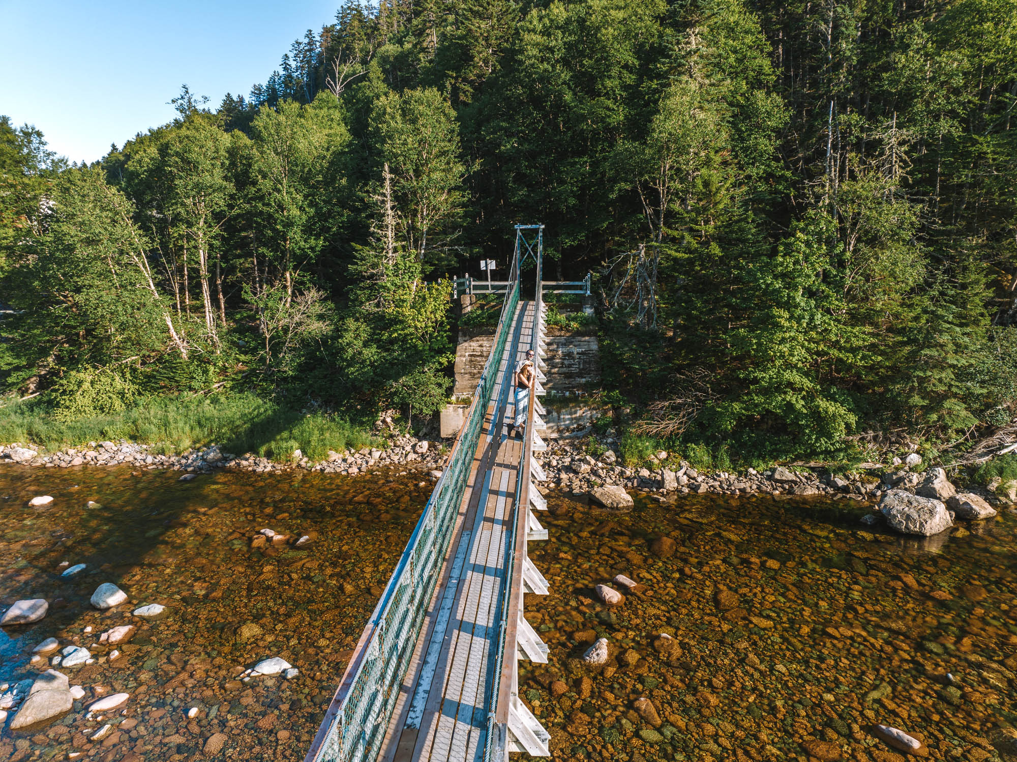
Mitchell Franklin Bridge – the bridge, located at the heart of the Central Section, connects two sides of the Big Salmon River. You’ll cross the bridge en route.
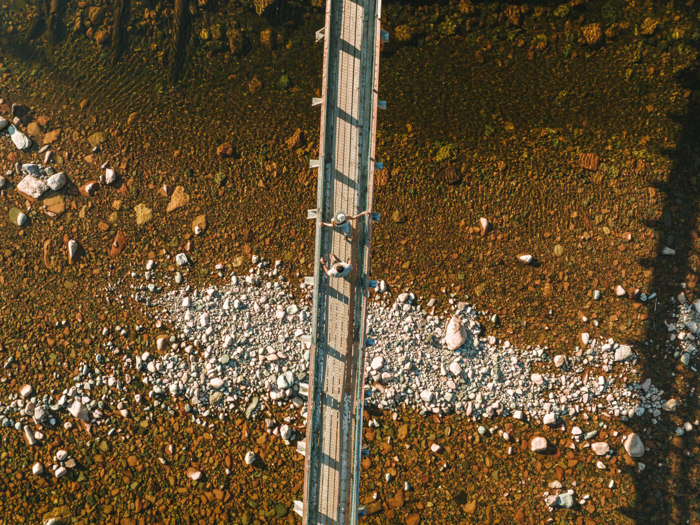
Big Salmon River Suspension Footbridge – A 84 m (275 ft) suspension footbridge over the Big Salmon River runs just 5-minute walk from the Mitchell Franklin Bridge. It’s a popular point of interest on the parkway for the sheer fun of the experience.
Interpretive Centre – Originally the house of the single men who worked and lived here, the centre now hosts daily talks. Additionally, it offers washroom facilities, snacks, and souvenirs. The interpretive centre is also home to original artifacts and old photographs from the era when the benevolent Pejepscot Paper Company provided housing, a schoolhouse, and a community centre. The centre was the heart of the Big Salmon River community.
Long Beach Lookout – This lookout features four picnic tables, and it’s one of the visitor’s favourite spots for photos. Up until 2018, the lookout used to mark the end of the old Fundy Trail.
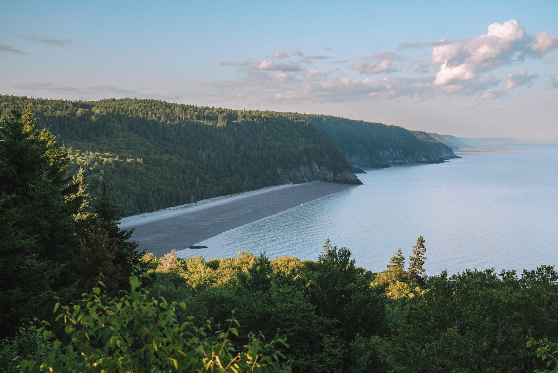
Long Beach – One of the best places in Canada to witness and experience a spectacular horizontal tide. At low tide, the beach exposes a 2,5 km (1,5 mile) long shoreline perfect for exploring.
Long Beach Brook Falls – The hike towards the falls is moderate, with a few steep sections, but the view is worth it if you have the time.
Seely Beach – This is a relatively flat cobble beach that, at low tide, extends out across the beach and reaches the bay.
Eastern Section
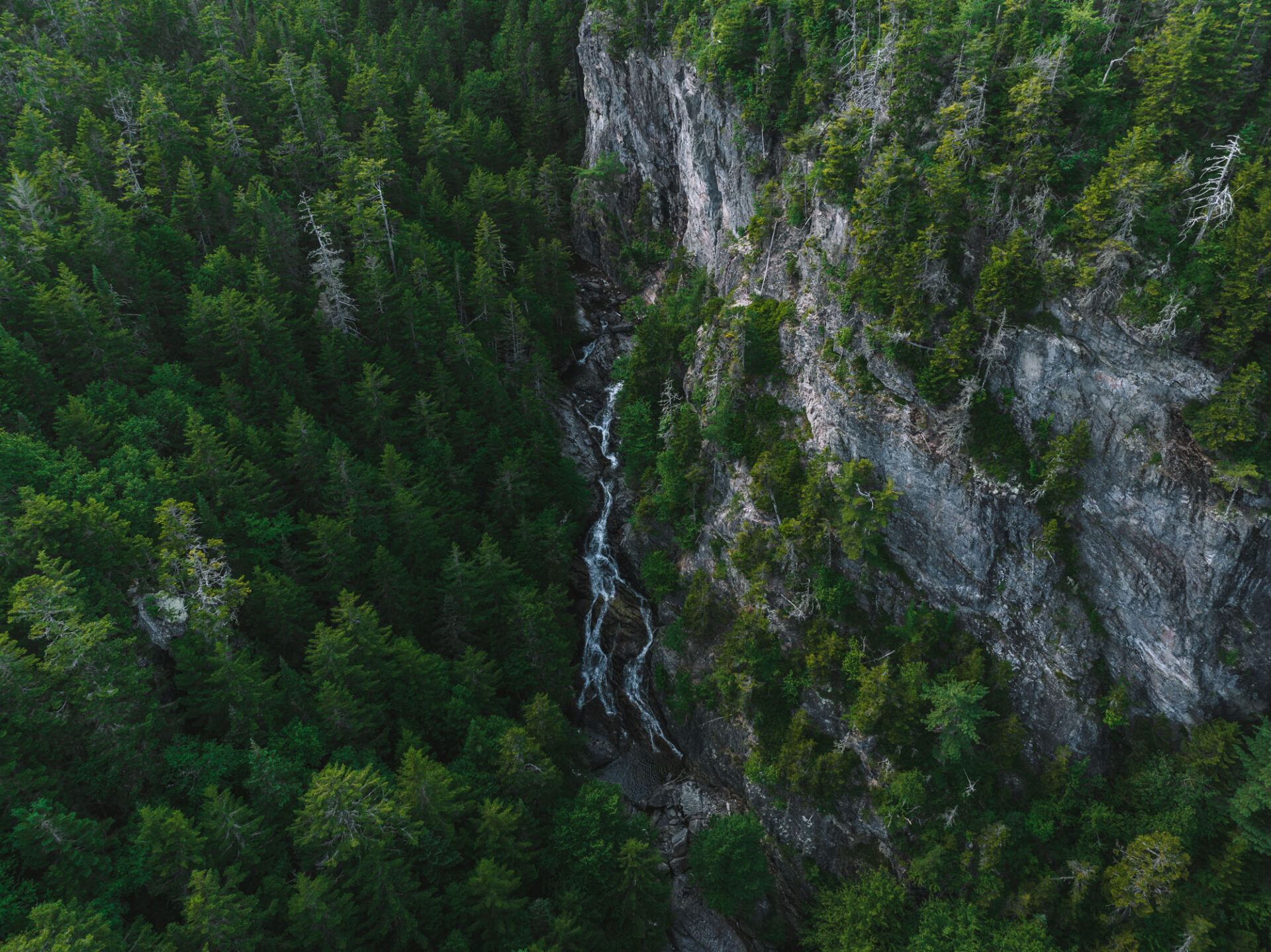
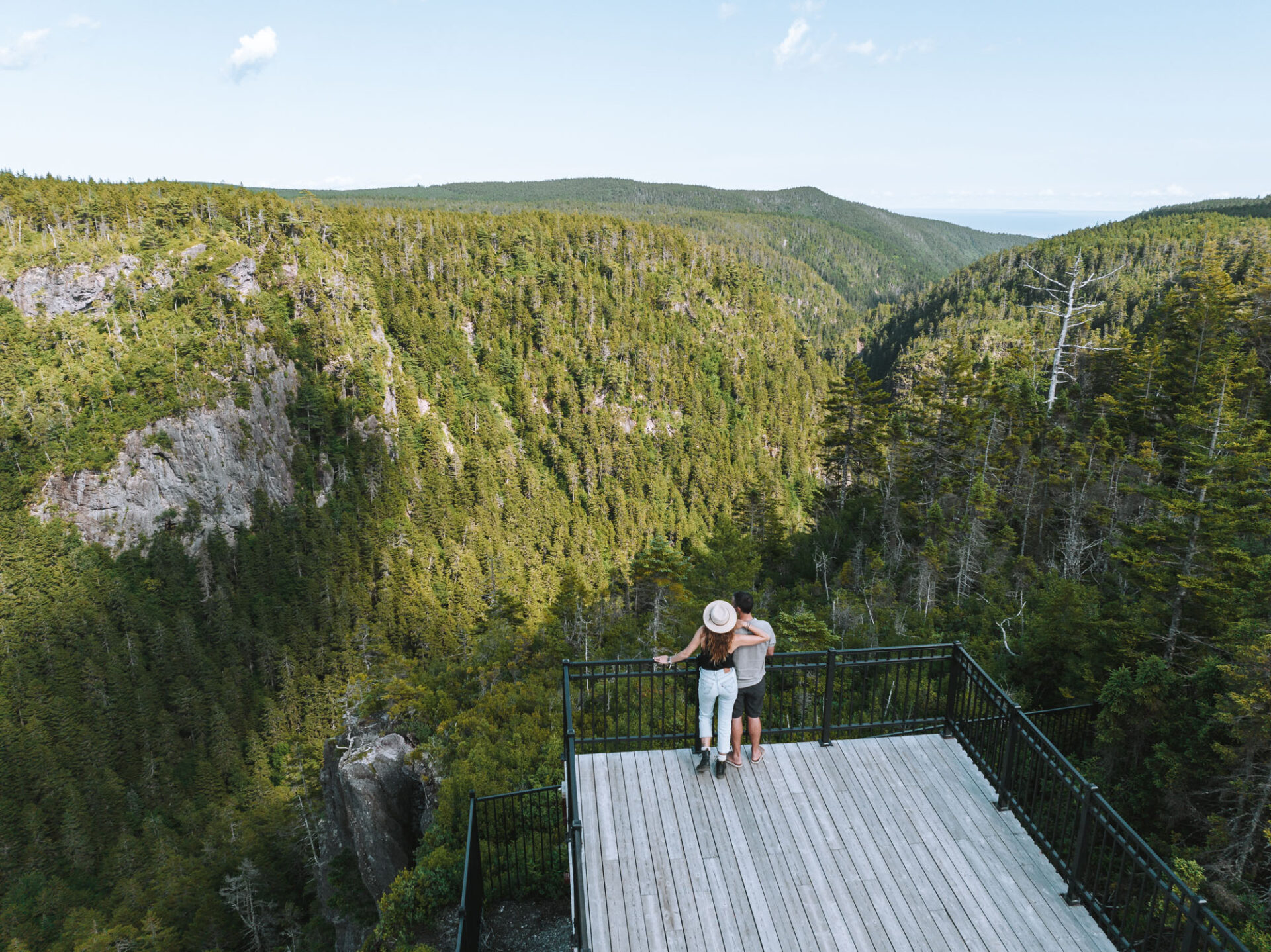
The Eastern Section of the park veers away from the coast and heads into the impressive UNESCO Fundy Biosphere Reserve. The scenery on this part of the parkway is unlike anything you had seen in Western or Central sections, with Walton Glen Gorge stealing the show.
Walton Glen Gorge – The gorge is a Protected Natural Area (PNA), an example of a coastal river ravine, and steep cliffs. The gorge offers the perfect environment for rare provincial flora. It is sometimes referred to as the “Grand Canyon of New Brunswick.” The gorge is a short walk away from the parking lot. Also, the lookout at the end offers stunning views – a must-visit!
McLeod Brook Falls – Starting at Walton Glen Reception Centre, the trail to McLeod Brook Falls is an easy hike that offers lovely views of the falls over moss-covered rocks.
McCumber Brook Wetlands – Another easy 1.2 km (0.7 miles) hiking trail starting from the Wetlands observation deck. It offers an opportunity to learn about the unique soil characteristics and vegetation of the wetlands.
READ NEXT: Best Things To Do In New Brunswick
Guided Tours:
Papga’sit: Down the Coast Guided Tour by First Nations Storytellers – The Mi’kmaq people called this area home long before European settlers and worked in a delicate balance with nature for subsistence. During this guided walk, you’ll discover the local history of the area from a indigenous point of view, and how the protection of this area is so important.
The Art of Water Guided Tour – During this guided hike, you’ll learn about the geological processes that created the stunning waterfalls, cliffs, beaches, and caves along the Fundy Trail Parkway. The tour is dependent on low tide times, and the hike can be a bit strenuous at points, so make sure to wear some sturdy hiking footwear.
Molasses and Tea – For a tasty bit of Fundy history, join a talk where you get to sip on King Cole tea and snack on some of the famous Fundy Trail molasses cookies. Settle in while your guide takes you back in time and explains the connection between the tea, Crosby’s molasses, and the shipbuilding industry. This event is hosted by the Fundy Trail Cookhouse, and reservations are required.
Travel Tips & Advice:
- Plan to spend at least 3-5 hours en route to enjoy the parkway and its top attractions. Spend the whole day to make the most out of your day. Have the time to explore the entire Park.
- Save the most popular attractions, like the Walton Glen Gorge and Flowerpot Footpath, to early in the morning or in the evening to avoid crowds. We chose to explore the parkway in the afternoon and found very few people on the trail with us.
- Travel from West to East as all lookout points are located on the right-hand side and are easier to turn into from the road. There are also more activities and things to do in the Western section of the Parkway. So, you can tackle them while you still have lots of energy.
- Pack a picnic and bring lots of water and snacks, as facilities inside the park are scarce. There are a few restaurants in the western section, like The Caves Restaurant and Periwinkles at Beach Street Inn, but they can get very busy during the high season.
- Make it a Bay of Fundy adventure by combining your visit to Fundy Trail Parkway with a stay in St Martins and a visit and stay in Fundy National Park. Continue along the coast to visit Hopewell Rocks and finish your trip in Moncton.
- Pay attention to the tide levels, as they can affect your ability to hike, bike, or access some parts of the park safely.
- Download the parkway map so you can plan out your adventure and find your way to restrooms when you need to.
Have You Ever Been To The Fundy Trail Parkway? What Was Your Favourite Part About The Hike?
Disclaimer: We visited Fundy Trail Parkway as guests of Tourism New Brunswick, but, as always, all opinions expressed in this article are our own

Love, love, love the scenery! The photos looks amazing!
Would love to visit this someday!
Thanks for posting this! Another one added to the list.