

Cutting through the red sands of northern South Australia, the Oodnadatta Track is one of Australia’s classic outback roads. It runs roughly 620 km (385 miles) from Marree in the south to Marla in the north, an unsealed route that is rough around the edges and all the more fun for it. The track itself is the attraction, with a side of crumbling Ghan railway sidings, trickling mound springs, and quintessential outback scenery.
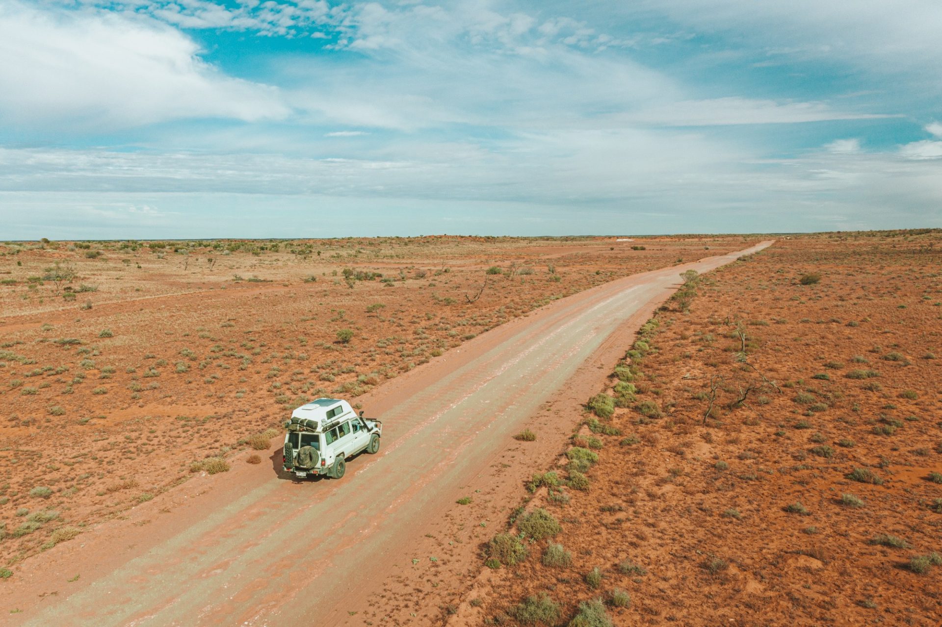
We drove it in our converted 4WD Troopy, tackling the southern half from Marree up to William Creek before peeling off toward Coober Pedy, and we found it well worth the bumpy roads and dust. Honestly, with the right tyre pressures and sensible driving it was one of the more straightforward outback tracks we have done. This guide covers everything you need to plan it: the route and distances, current conditions, the must-see stops, and where to camp or stay.

Oodnadatta Track at a Glance
| Route | Marree to Marla, northern South Australia |
| Distance / drive time | About 620 km (385 mi), roughly 9 hours of driving |
| How long to allow | 2 to 3 days to enjoy the stops |
| Vehicle | 4WD recommended; 2WD and off-road campers possible when dry |
| Best time | Australian winter, May to September (cooler, drier) |
| Surface | Unsealed gravel, corrugated; impassable after heavy rain |
| Don’t miss | Mound springs, Coward Springs spa, Lake Eyre, William Creek |
| Check before you go | Live road conditions at SA OutbackRoads |
About the Oodnadatta Track
The Oodnadatta Track is a legendary unsealed outback road that follows a traditional Aboriginal trading route from Marree to Marla, running through semi-desert dotted with waterholes and springs fed by the Great Artesian Basin. You will skirt the southern edge of Lake Eyre National Park and pass through tiny outback settlements like William Creek and Oodnadatta.
It became the route for the Overland Telegraph and the Old Ghan Railway, which left behind a string of rust-coloured sidings and ruins, and it roughly traces explorer John McDouall Stuart’s path across the continent. It is one of the tamer southern outback tracks, which makes it a great first taste of off-road desert driving. It is also a far more interesting alternative to the sealed Stuart Highway if you are heading to Coober Pedy or down to the Flinders Ranges.
Oodnadatta Track Map, Route & Distances
The track is usually driven in three legs between its anchor towns. Here is the route at a glance, with the handy turnoff to Coober Pedy that many travellers (us included) use to rejoin the Stuart Highway.
| Leg | Distance | Drive time |
|---|---|---|
| Marree to William Creek | 204 km (127 mi) | ~2.5 hours |
| William Creek to Oodnadatta | 201 km (125 mi) | ~2.5 hours |
| Oodnadatta to Marla | 217 km (135 mi) | ~4 hours |
| Full track: Marree to Marla | ~620 km (385 mi) | ~9 hours driving |
| Turnoff: William Creek to Coober Pedy | ~166 km (103 mi) | ~2 hours |
You can open the full route in Google Maps to plan your stops and fuel. Note that mobile coverage is patchy to non-existent for long stretches, so download the map offline and carry a paper backup.

Oodnadatta Track Conditions: Is It Open and Do You Need a 4WD?
Checking current track conditions before you set off is essential, and a little preparation goes a long way. Dropping your tyre pressure (around 25 psi works well) and slowing down for creek crossings and rutted sections keeps the drive smooth and saves your vehicle. We followed the standard tyre-pressure and driving advice and had no trouble at all.
Rainfall is everything out here, and dry conditions are ideal. A 4WD is recommended over a 2WD sedan: while it is a well-maintained gravel road, you can hit washouts, sandy patches, potholes, and corrugations, especially between William Creek and Oodnadatta. After heavy rain the track can be closed or passable only in a 4WD, and driving a closed outback road can land you with a hefty fine and a recovery bill.
Always check the official SA OutbackRoads conditions and respect every warning and sign. Print a Pink Roadhouse mud map, carry at least one spare tyre, pack plenty of water and fuel, and fit a UHF radio. It is also smart to travel with travel insurance that covers remote areas, and an eSIM helps you connect at the few spots with reception.
Oodnadatta Track Itinerary: The Best Stops
Leg 1: Marree to William Creek (204 km, 2.5 hours)
This first leg, which we drove ourselves, holds many of the track’s highlights: the mound springs, Lake Eyre, and the lovely Coward Springs campground.
The Dog Fence
The famously long South Australian dog (dingo) fence spans 5,400 km and protects sheep country from dingoes. It is not much to look at, but the story behind it is fascinating. You will see a stretch just west of Marree, which is also where you can link up with the Birdsville Track heading north into the Simpson Desert.

Alberrie Creek and Mutonia Sculpture Park
Heading north from Marree, you cannot miss the art at Alberrie Creek. This former Old Ghan siding is now home to Mutonia Sculpture Park, an installation of metal sculptures made from recycled scrap, including two towering planes (Plane Henge) and a giant metal dingo. You can also poke around old railway sidings, a former rocket-tracking site, and a telegraph repeater station ruin nearby.

Curdimurka Railway Siding
There are railway sidings all along the track, some better preserved than others. Curdimurka is one of the best, with a desalination tower, bridge, and railway building still standing. It is a good place to stretch your legs and picture the old Ghan rolling through.

Lake Eyre South Lookout
Lake Eyre (Kati Thanda) is the lowest point in Australia and the country’s largest salt lake, and for most of the time it is exactly that, a vast dry salt pan. It only fills properly a handful of times a century, so seeing it holding water is a genuinely rare treat, and we were lucky enough to catch it with water on our trip. In recent years it has flooded again, drawing crowds to the scenic flights.
The Lake Eyre South lookout right on the track is the easy roadside view, and its southern lobe is often dry and crusty even when the main lake further north holds water. To really appreciate a flooded Lake Eyre, the move is a scenic flight over Lake Eyre from Marree or, better positioned, from William Creek.


Margaret Siding Ruin
Pull over at Margaret Siding to see a crumbling 1800s fettlers’ cottage. Fettlers were the crews who lived in remote cottages along the line and kept the railway in repair, ready to jump on damage at a moment’s notice. Margaret Siding was one of their base camps.

Mound Springs: Blanche Cup and The Bubbler
Some of South Australia’s most striking mound springs sit in Wabma Kadarbu Mound Springs Conservation Park. Thirrka (Blanche Cup) and Pirdali-nha (The Bubbler) are the famous two, fed by the Great Artesian Basin, deeply significant to the local Arabana people, and a haven for waterbirds. Both are an easy walk off the main road, though swimming is not permitted.


Coward Springs
One of the larger former railway stations on the track, Coward Springs is a must-stop. The restored station is now a heritage site and campground with an unexpected bonus: a natural artesian spa. You can soak in the spring-fed tub for a couple of dollars, but time it well, as it only fits two to four people. Shaded by date palms and athel pines, with a rare patch of 4G reception, it is one of the best overnight spots on the whole track.


Irrapatana Sandhills
The red sandhills along this stretch are outliers of the nearby Simpson Desert, and the road runs right through the dunes, ridges, and clay pans. It is some of the most photogenic driving on the southern leg.

William Creek
William Creek is one of the smallest towns in Australia (population about 10), built around the iconic William Creek Hotel. It is the main gateway to Lake Eyre scenic flights and gets busy when there is water in the basin. With fuel, food, drinks, a pub, a campground, and patchy reception, it makes an easy halfway overnight stop, and it is where the road branches off toward Lake Eyre, Halligan Bay, and the turnoff to Coober Pedy.

Where to Stay: Coward Springs or William Creek
Coward Springs and William Creek are the most popular camping spots on the track, both with tent and caravan sites, toilets, and showers (around $12 to $15 per person). If camping is not your thing, the William Creek Hotel has rooms and air-conditioned cottages, and it pays to book ahead in the busy winter months.
Leg 2: William Creek to Oodnadatta (201 km, 2.5 hours)
Note that this is the point where we cut north to Coober Pedy rather than continuing the full track, so we cover the rest from research and local advice as much as first-hand. It is the more remote middle leg, with the track’s biggest cattle station and most photographed bridge.
Anna Creek Station
Just outside William Creek is Anna Creek, the largest cattle station in the world (bigger than some countries). It was once a repeater station on the Overland Telegraph and had mound springs nearby, now dry, but it is still a worthwhile stop.

Edwards Creek and the Halfway Point
Cross this shallow, shady creek and watch for one of the late Pink Roadhouse owner Adam Plate’s handmade pink signs, which dot the entire track. This one marks the official halfway point, with some welcome encouragement for the remaining 320 km.

Peake Telegraph Station Ruins
With a capable 4WD, the rough, slow detour to the ruins of the old Peake Telegraph Station is worth it. Once a repeater station, small village, and mine, the crumbling fettler cottages have been partially restored by Heritage SA, and you can easily spend an hour or two exploring.
Algebuckina Bridge
The most photographed bridge on the track, Algebuckina is the longest railway bridge in South Australia at 578 metres. Built so the Ghan could cross the Neales River in flood, it still towers above the water. There is a free campsite about a kilometre away on the east side, with one of the track’s few permanent waterholes and lovely sunset views back to the bridge.
Mt Dutton Lookout
Another Old Ghan siding, Mt Dutton has historic ruins and a tall structure visible from the road, plus the grave of workers who died during the gruelling railway construction.
Leg 3: Oodnadatta to Marla (217 km, 4 hours)
Oodnadatta and the Pink Roadhouse
The track’s namesake town is a true outback icon, home to the unmissable Pink Roadhouse. Adam Plate of the Oodnadatta Progress Association named the Oodnadatta Track in 1980, and it has had cult status ever since, completing a trilogy of unsealed routes alongside the Birdsville and Strzelecki Tracks. Travellers come from all over for mud maps, insider info, a cold beer, and a bite, with both Optus and Telstra reception and on-brand pink fuel pumps. You can stay nearby for around $15 per person at the Oodnadatta Caravan Park or the free camp.
From Oodnadatta, many travellers (as we did from William Creek) detour to Coober Pedy, optionally via the striking Painted Desert, before rejoining the Stuart Highway. It is Australia’s opal capital and a worthy stop in its own right, as the guide linked below explains.
Kathleen Creek
The final stretch veers away from the Ghan line, so there is less history, but plenty of pretty waterholes and creek crossings with cattle wandering about. Kathleen Creek is a peaceful, shady spot with camping along the Todmorden Station turnoff.
Marla
The track ends at the sleepy town of Marla on the Stuart Highway, with all the facilities a road trip needs: clean toilets, much-needed showers, fuel, and a pool at the Marla Travellers Rest. Re-inflate your tyres here, and keep an eye out for the modern Ghan train passing through on the new line.

More Australian Outback Drives
If the Oodnadatta gives you a taste for red dirt, it is one of three classic South Australian outback tracks alongside the Birdsville and Strzelecki. Further afield, the Gibb River Road in the Kimberley is the next big bucket-list 4WD adventure, and the remote Tanami Track cuts across to the Northern Territory. For more inspiration, see our roundup of the best road trips in Australia and our full Australia itinerary, and if you are kitting out a rig, our guide to campervan and 4WD hire in Australia covers the practicalities. The track also pairs naturally with Uluru and the Red Centre to the north.
Oodnadatta Track: Frequently Asked Questions
Where Does the Oodnadatta Track Start and End?
The Oodnadatta Track runs between Marree in the south and Marla in the north, both in outback South Australia. Most people drive it south to north or combine it with a detour to Coober Pedy on the Stuart Highway.
How Long Does It Take to Drive the Oodnadatta Track?
Marree to Marla is about 620 km and roughly 9 hours of pure driving, but this trip is about the journey. We recommend allowing at least 2 to 3 days to space out the drive and enjoy the stops.

Do You Need a 4WD for the Oodnadatta Track?
A 4WD is recommended and is essential after rain, but the track can be done in a 2WD or an off-road camper when it is dry and you drive carefully with reduced tyre pressure. Always check current conditions first.
What Is the Best Time to Drive the Oodnadatta Track?
The Australian winter and shoulder seasons, roughly May to September, are best, with cooler temperatures and a lower chance of rain closing the road. Summer is dangerously hot out here and best avoided.
Is the Oodnadatta Track OK for Caravans?
With the right preparation it can be done in off-road campers and sturdy caravans, but the unsealed, heavily corrugated surface is hard on rigs. We would not take a shiny new on-road caravan, having seen plenty of travellers shake bits off theirs on these corrugations.
Is the Oodnadatta Track Sealed, and Is It Open Now?
No, the entire track is unsealed gravel. It is usually open in dry conditions but can close after heavy rain. Always confirm it is open before you go using the official SA OutbackRoads conditions report.
Final Thoughts on the Oodnadatta Track
The Oodnadatta Track is the rare drive where the road itself is the destination: railway ghosts, bubbling springs, a salt lake the size of a small country, and that big, empty outback silence. With a little preparation and a check of the conditions, it is one of the most rewarding and beginner-friendly outback adventures in Australia. Have you driven the Oodnadatta Track? What was your favourite stop along the way? Let us know in the comments below.

Leave a Reply