The closest mountain range to Alice Springs, the MacDonnell Ranges, is the tallest mountain range in Central Australia.
*This post may contain affiliate links, as a result, we may receive a small commission (at no extra cost to you) on any bookings/purchases you make through the links in this post. As an Amazon Associate, we earn from qualifying purchases. Read our full disclosure
The MacDonnell Ranges are split into two sections known locally as the West Macs and East Macs. Each section has its own set of attractions.
The West MacDonnell Ranges boast swimming holes and gorges and a collection of amazing places that include Glen Helen, Alice Springs, Kings Canyon and Watarrka National Park.
The East Macs hold great cultural significance and feature rocky red cliffs, deep gorges and sandy banks. Needless to say, there are endless opportunities for hiking, swimming, and camping across the MacDonell Ranges!
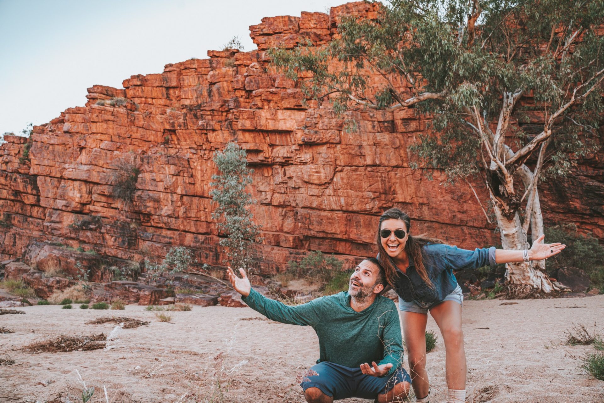
We spent a week exploring this region in June during our half-lap of Australia. Having experienced every gorge and attraction firsthand, we’ve outlined all of the can’t-miss spots to visit in the MacDonnell Ranges’ ancient landscape.
Check out our West MacDonnell Ranges itinerary below!
Traveling Soon? Here is a list of our favourite travel providers and accessories to help get you ready for your upcoming trip!
Where are the MacDonnell Ranges Located
The MacDonnell Ranges span 644 kilometres and are located in the Northern Territory in Australia. The Ranges surround the outback town of Alice Springs. To the west of Alice Springs are the West MacDonnell Ranges, and naturally, to the east are the East MacDonnell Ranges.
The mountainous zone covers many protected areas. These include discovery parks and national parks like Tjoritja/West MacDonnell National Park, Trephina Gorge Nature Park, N’dhala Gorge Nature Park, and Yeperenye/Emily and Jessie Gaps Nature Park.
Opening Hours, Passes, And Permits
West MacDonnell National Park and the East MacDonnell Nature Parks are open year-round. However, heavy rainfall in the wet season (November-April) can cause road closures, so always double-check park openings before your visit.
All of the MacDonnell Ranges parks are free to visit, with the exception of Standley Chasm. It’s privately owned and costs $12 per adult to enter. No special permits are required to enjoy the parks.
Best Time To Visit
The cooler months are the best time to visit the West MacDonnell Ranges and Alice Springs. Visitors probably don’t want to be hiking in January heat, so plan your trip between April – September.
Spring (September – November): Spring is a delightful time to visit this region. The temperature during the day ranges from 25 to 35°C. Water temperatures in the gorges are relatively cool, perfect for swimming. There isn’t much rain during this time.
Summer (December – February): Warmer months are harsh in this region, with temperatures reaching up to 40°C. This isn’t ideal for hiking, and the water temperature in the gorges is warm enough to make it unpleasant for swimming either. Heavy rainfall and thunderstorms are common throughout these months, making it the least popular time to visit the Macs.
Autumn (March-May): Autumn serves as a transition period with more moderate temperatures starting to appear, making it a suitable time for exploration. Temperature throughout the day is between 25°C – 35°C, and water temperatures are comfortable for swimming. Precipitation is generally low.
Winter (June – August): Winter months are the best and the busiest time when most travellers visit. Early mornings and nights can be super chilly, with temperatures dropping below zero! Daytime temperatures range from 20°C to 30°C. Water temperatures in the gorges may be cool. Rainfall isn’t much during this season, and everything will look dry.
READ NEXT: The Guide To Visiting Uluru-Kata Tjuta National Park
How To Get To The West MacDonnell Ranges
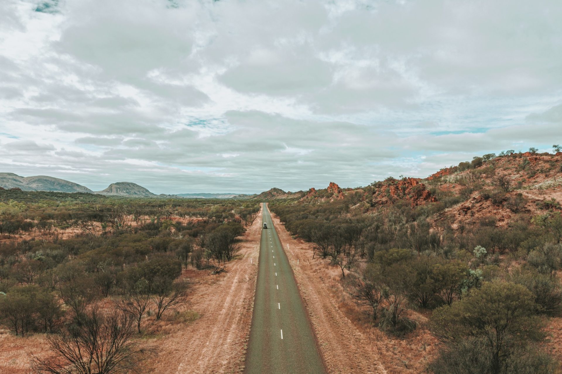
By Car: Both roads are sealed from Alice Springs, and attractions start just 15 minutes from town.
If you’re coming from the south near Kings Canyon, you’ll need a permit to access the unsealed Mereenie Loop along the Red Centre Way. The permit for the Mereenie Loop is $5 and can be purchased at the Alice Springs Visitor Centre or Kings Canyon Resort.
By Plane: Those visiting from other parts of Australia can fly into Alice Springs and hire a car from there. There are daily flights from Brisbane, Sydney, Adelaide, and other major cities.
On a Tour: Whether driving or flying into Alice Springs, joining a West MacDonnell Ranges tour is a great option. This full-day tour hits all the highlights and includes transportation from Alice Springs.
The easiest way to navigate the MacDonnell Ranges is by car. You don’t need 4WD to do a West MacDonnell Ranges self-drive, but you will if you plan to hit the East Macs, too.
We recommend joining a 4X4 Tour of the East MacDonnell Ranges for a full day of exploration.
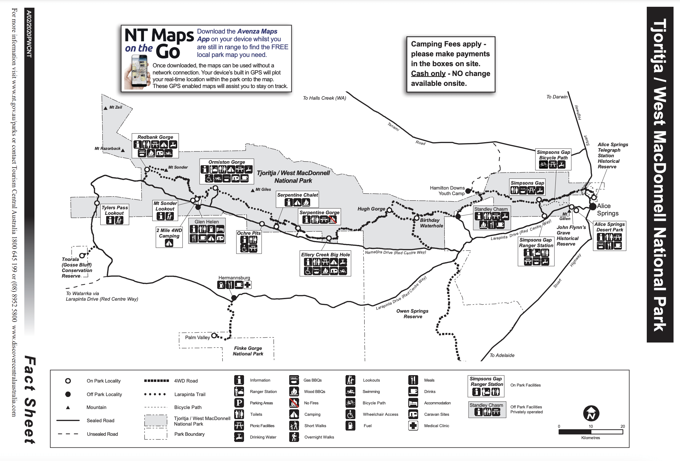
Things To Do In The West MacDonnell Ranges
Redbank Gorge
At the far west end of the MacDonnell Ranges, Redbank Gorge is a beautiful gorge and chasm. It’s often missed as many day trippers simply turn around at Ormiston Gorge and head back to Alice Springs.
The road there is unsealed, so a high-clearance vehicle is recommended to reach the start of the trail. From the car park, follow the 2-kilometre walking track to a stunning waterhole at the foot of Mount Sonder. Along the way, look out for the many species of plants and animals that call the gorge home.
Swimming is permitted in the gorge, but brace yourself for freezing cold water! After your refreshing swim, you can camp at one of the two Redbank Gorge campgrounds and enjoy basic facilities.
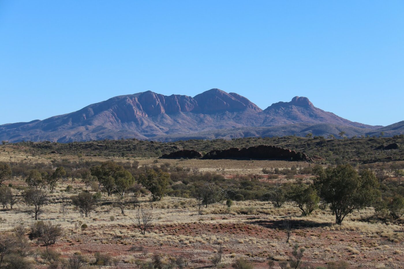
Mount Sonder Lookout
Take a break on your way to Glen Helen Gorge to admire the sweeping views of Mt Sonder. You can choose between a 5-kilometre return trip to Mount Sonder Lookout or continue on for the full 15-kilometre hike to the summit, which shows the area’s beautiful scenic landscape.
If you’re an early bird, try and catch the sunrise here—or if you’re like us, a sunset is great too!
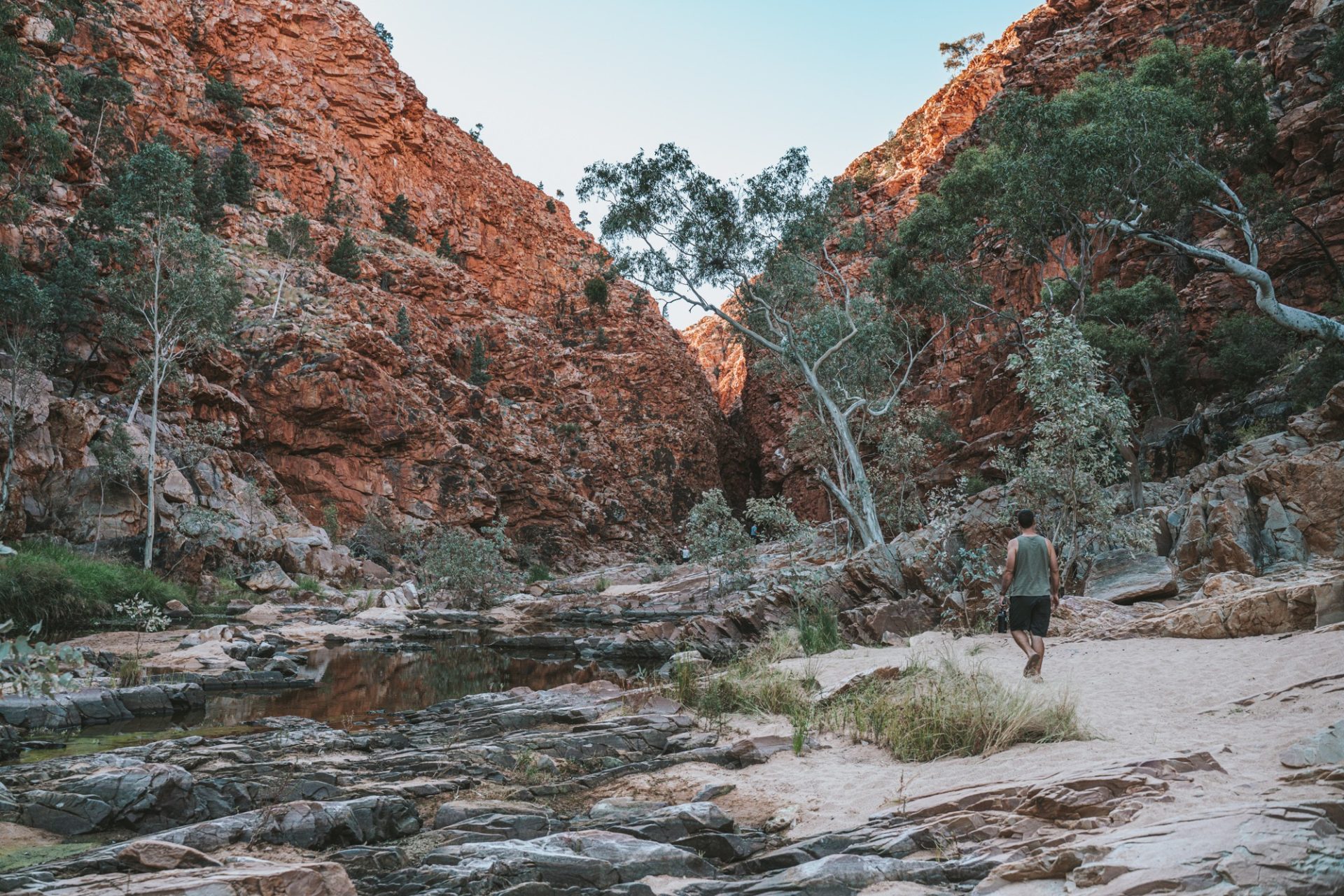
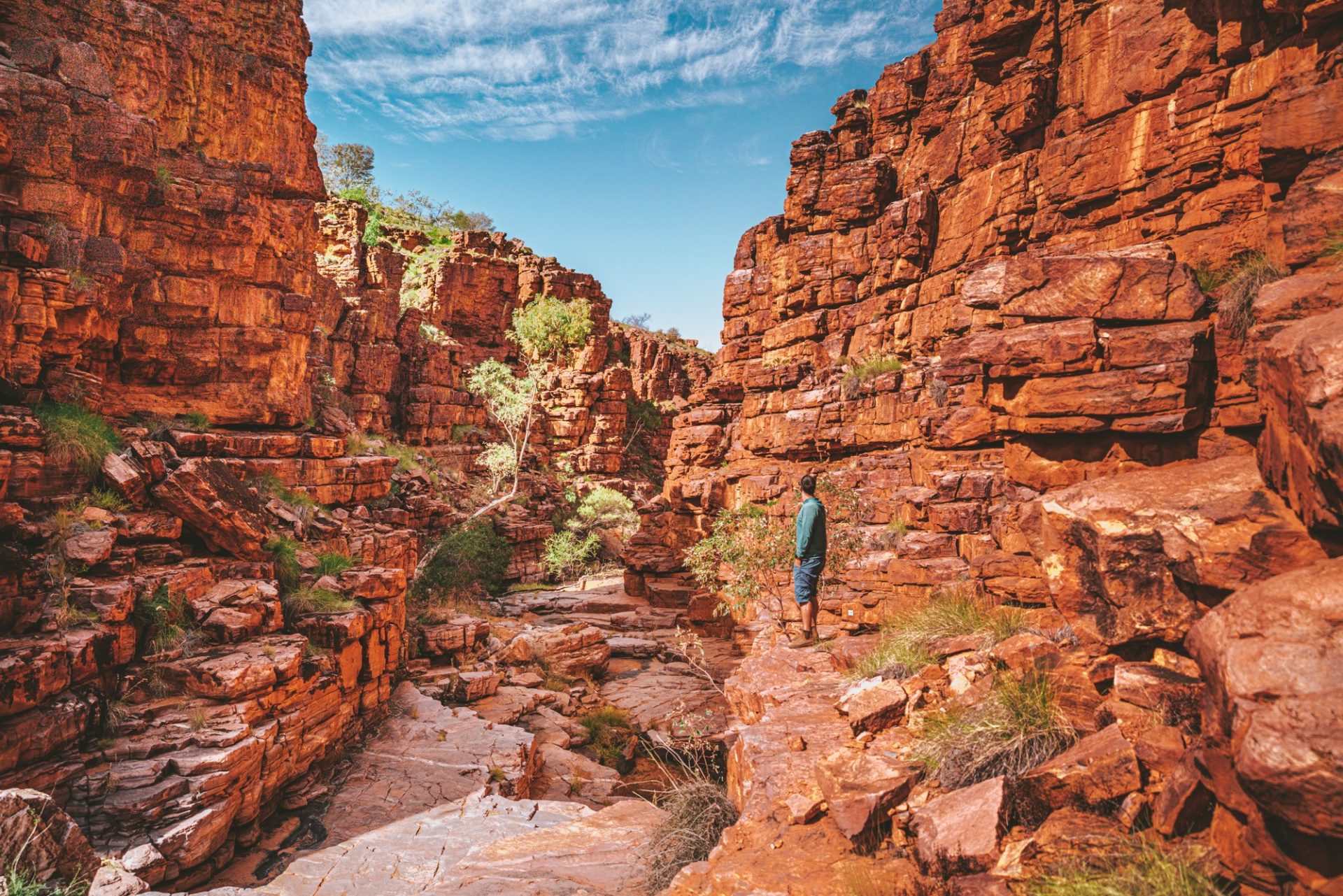
Ormiston Gorge
Ormiston Gorge is a fantastic base camp to explore the West MacDonnell Ranges with great hikes and a beautiful swimming hole. There are a couple of walks starting from the visitor centre:
- Ormiston Pound Walk – Grade 3, 3-4 hours, 8.5 km walk follows the full circuit from the Information Shelter, meandering around scenic slopes, returning along Ormiston Gorge via the main waterhole.
- Ghost Gum Walk (2.5 km) – Grade 3, 2.5km loop walk,1.5 hours. This beautiful trail starts off steep, with some 200 steps to climb to the Ghost Gum Lookout. The trail then continues along the path around the western side of the Gorge and returns via the main waterhole.
- Ghost Gum Lookout (1.2 km) – Grade 3 walk to the top of the lookout
- Waterhole Walk (300m) – an easy, short trail to the base of the Ormiston watering hole.
Alternatively, spend the day cooling off in the swimming hole. Ormiston Gorge showcases much of the geology that makes the MacDonnell Range so special. Plus, the campground at Ormiston Gorge is the perfect place to spend a couple of nights under the stars.
Glen Helen Gorge
Glen Helen reopened its doors in August 2021 and is now run by Discovery Parks. The Gorge is located 132 kilometres west of Alice Springs in Northern Territory.
Carved by the meandering Finke River, the gorge is renowned for its towering red cliffs that create a dramatic contrast against the arid landscapes.
The permanent waterhole at the gorge’s base offers a tranquil oasis. Hiking trails wind through the terrain, providing opportunities to explore the unique geology and perhaps encounter glimpses of the region’s distinctive flora and fauna.
Beyond its natural allure, the gorge also holds cultural significance for the local Indigenous communities, weaving stories and traditions into the very fabric of the landscape.
Ochre Pits
Located 110 kilometres west of Alice Springs, the Ochre Pits are a sacred Aboriginal site where ochre has been mined for centuries. The vibrant bands of red, yellow, and white ochre that adorn the rock faces have been a source of cultural significance for thousands of years, utilised in Aboriginal ceremonies, art, and body painting.
Beyond its cultural importance, the Ochre Pits offer a visually stunning display against the backdrop of the rugged West MacDonnell Ranges.
You can explore the site through a walking trail that provides insights into the geological formations and imparts the cultural significance of ochre in Aboriginal traditions. Interpretive signs along the way offer a deeper understanding of the site’s history.
A gentle reminder to respect the ochre and its significance to Australia’s Aboriginal culture and refrain from touching, using, or removing it.
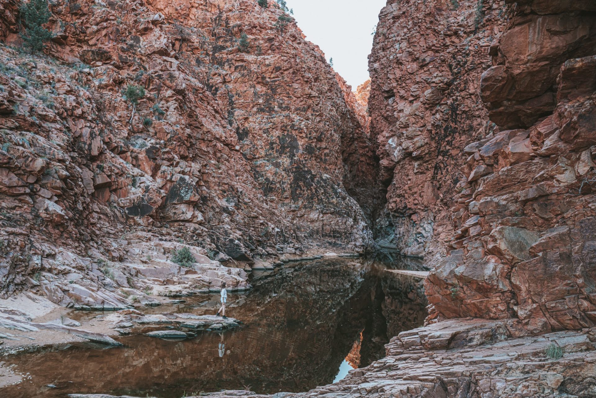
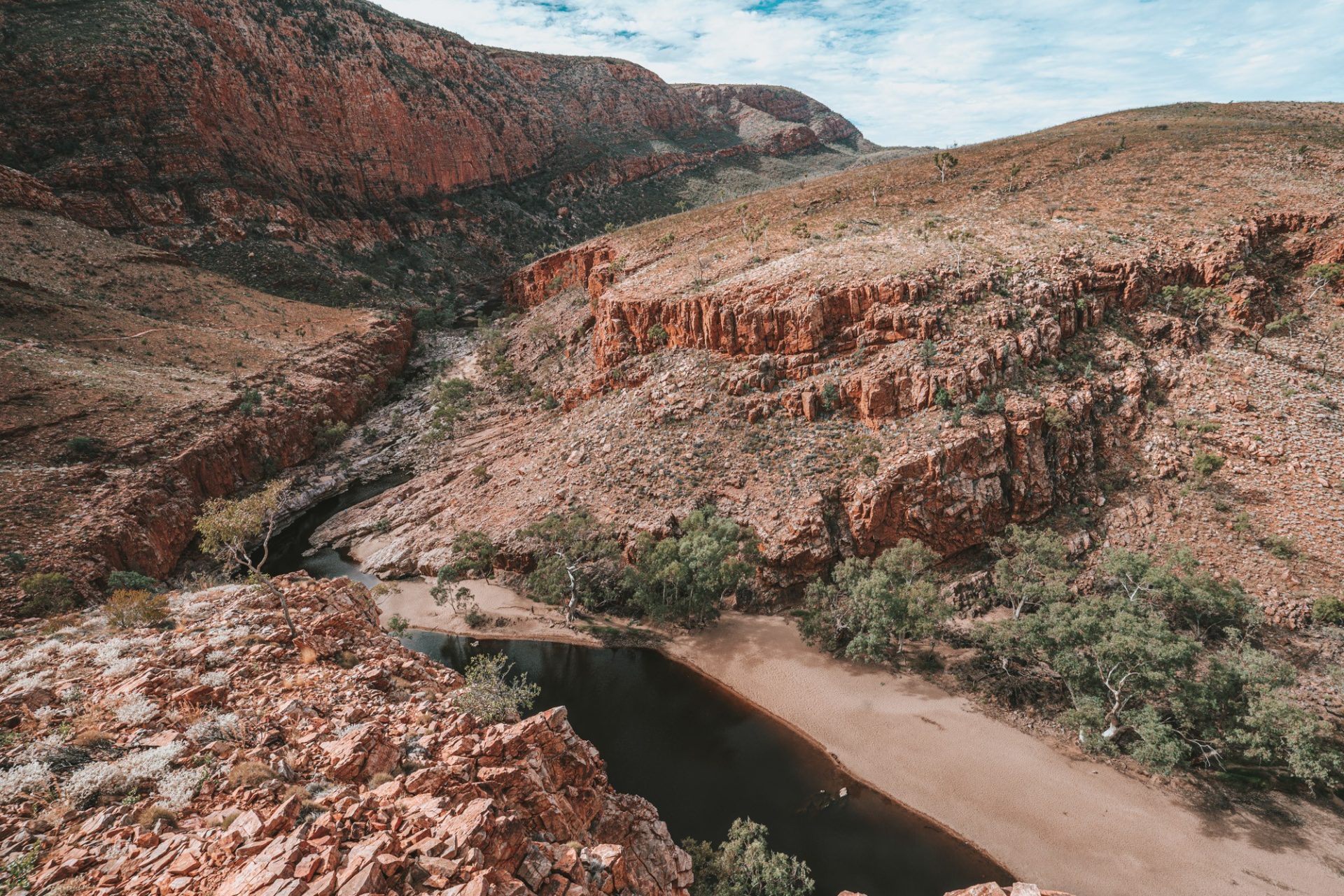
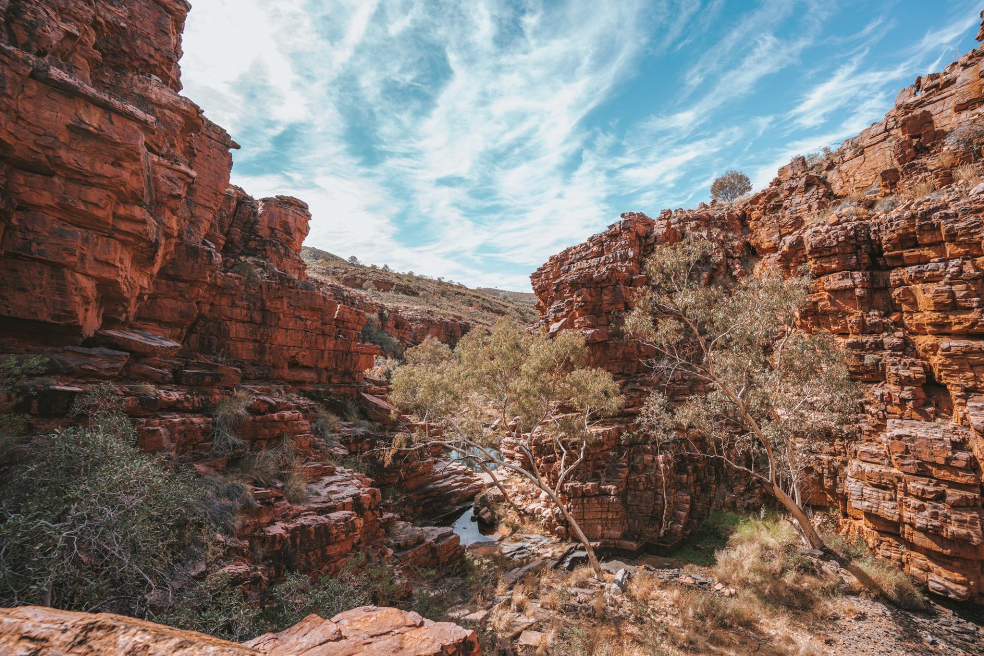
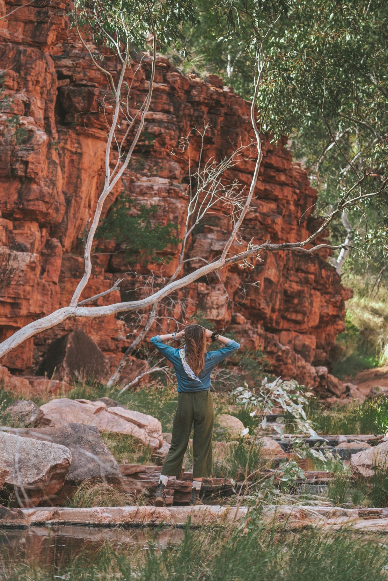
Serpentine Gorge
Lined by red river gums, Serpentine Gorge is one of the most beautiful gorges in the West MacDonnell Ranges in Australia’s Northern Territory. It is a narrow gorge located about 100 km west of Alice Springs along the famous Larapinta Trail, a 223-kilometre long-distance walking trail through the West MacDonnell Ranges.
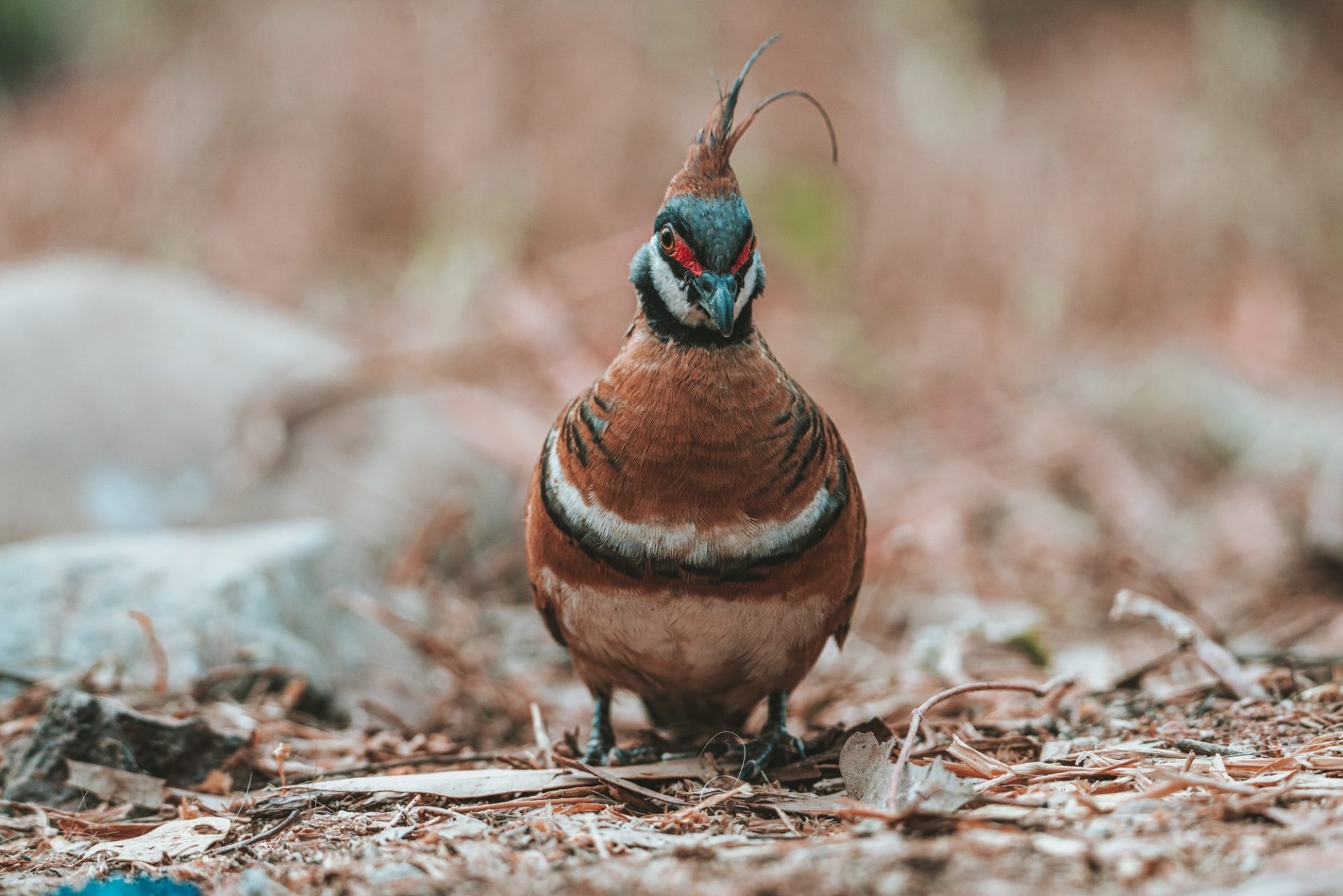
The gorge is surrounded by rocky cliffs and is a great spot for birdwatching in the West Macs.
Note that 4WD is recommended on the unsealed track to Serpentine Gorge. The best times to visit this trail are April through August.
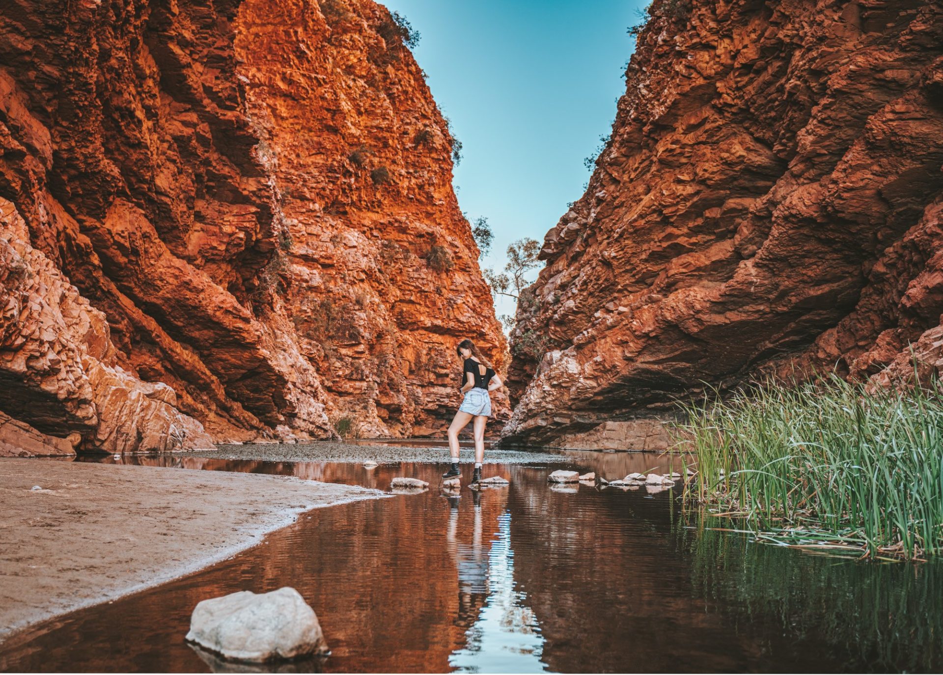
Ellery Creek Big Hole
One of the most popular sites in the West MacDonnell Ranges, Ellery Creek Big Hole is an amazing permanent waterhole. Perfect for swimming, hiking, and camping, Ellery Creek offers spectacular views of red cliffs and winding creeks. The water in the gorge is always very cold and can be uncomfortable, even on hot days.
Aside from the swimming hole, there are also a couple of walks at Ellery Creek for those looking to stretch their legs.
- Dolomite Walk (3 km loop walk – 1.5 hrs) is the most popular trail at Ellery Creek. It winds through the geological formations caused by massive floods. The walk is fairly easy but has some steady inclines.
- Ellery Creek Loop Walk (32.3km loop – 3 days) is another option suitable for more avid hikers. It forms a part of the Larapinta Trail.
Note that camping fees are paid via an honesty box system, and cash is the only payment method. Access to the gorge is via a sealed road. However, the last 2 km is unsealed.
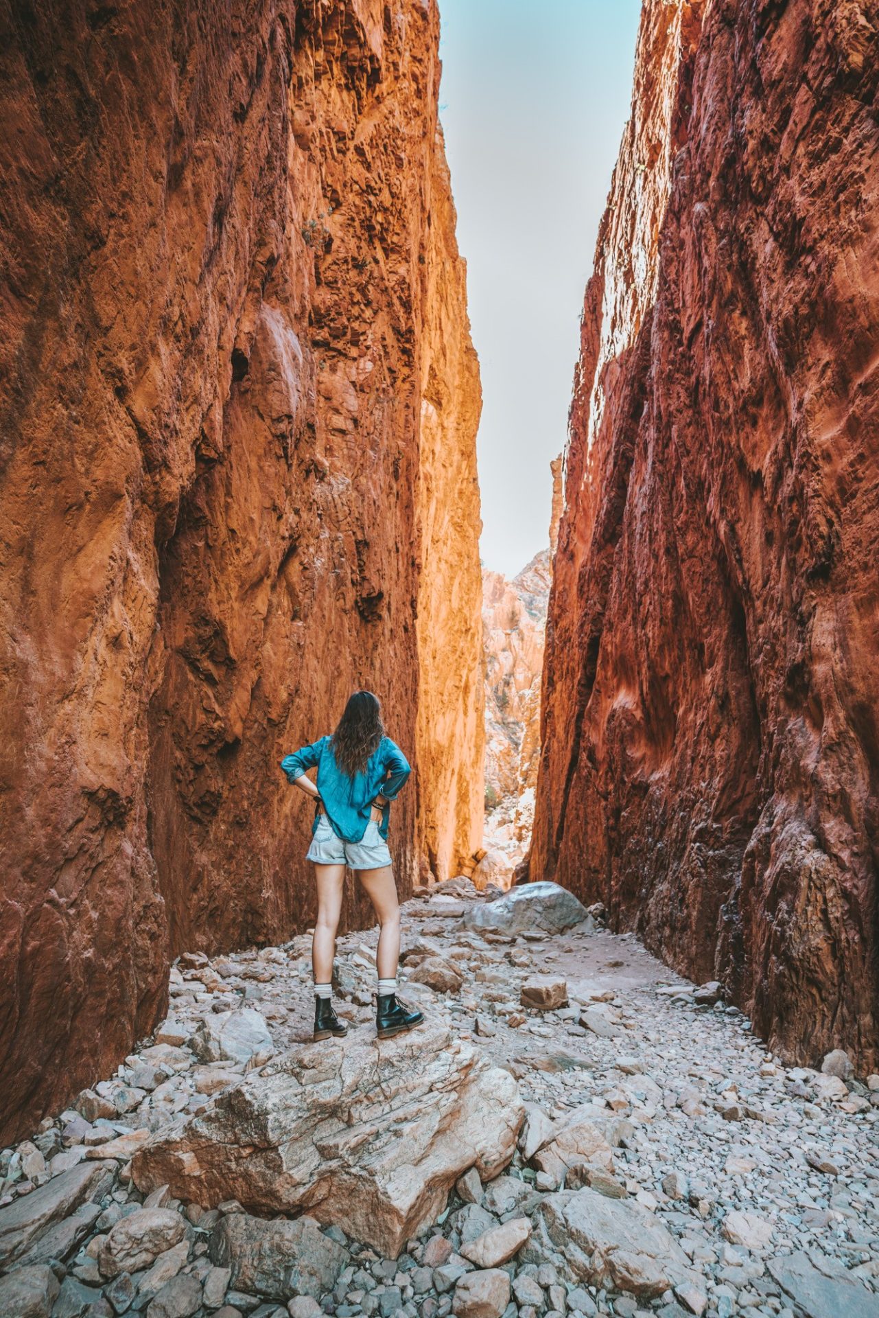
Standley Chasm
Considered a geological icon of Central Australia, Standley Chasm is a worthwhile stop in the West Macs. It’s just a short walk of 1.2 km along the creek bed to see dramatic views of the 80 m chasm. The entire area is incredible for birdwatching, wildlife viewing, and bushwalking.
Standley Chasm, or Angkerle Atwatye, is a culturally significant place for the local Aboriginal people and is managed by a local Aboriginal group.
Tourist access to Standley Chasm requires an entry fee of $12 per adult. There’s also a campground on-site for tents and caravans. Sites start at $18.50 per person.
Simpsons Gap
Simpsons Gap is one of the most notable gaps and favourite places in the West Macs. It’s known to be a hotspot for Black-footed Rock wallabies and rare vegetation. Hiking is a great way to explore Simpson’s Gap along the 3 scenic trails.
- The Ghost Gum Walk is an easy 15-minute trail through the trees.
- Cassia Hill is a 1.8 km trip overlooking Simpsons Gap and the surrounding range.
For a longer walk, the Woodland Trail spans 17 km all the way to Bond Gap and forms a part of the Larapinta Trail.
Larapinta Trail
Larapinta Trail is one of Australia’s most iconic bush walking tracks. The trail follows the ridge of the West Macs and covers 223 kms. The trail traverses the length of the ranges from Alice Springs to Mt Sonder and is split up into 12 sections.
The trail passes through every sight and attraction in the West Macs, making it the ultimate route to explore the West MacDonnell Ranges.
However, as you can imagine, hiking the trail requires a lot of planning and preparation, as all camping/cooking equipment, food, and other essentials must be carried with you on the trail.
Hiking the Larapinta Trail is most often done over the course of 2 -3 weeks, although there are many opportunities to extend the journey by splitting each section into smaller chunks.
READ NEXT: Visiting The Ikara Flinders Ranges National Park
Things To Do In The East MacDonnell Ranges
Trephina Gorge Nature Park
Surrounded by sparkling quartzite and towering red river gums, Trephina Gorge shows the beauty of the rugged East Macs. The nature park is great for a day trip from Alice Springs, where short walking tracks are plentiful.
Enjoy an easy walk on the Gorge Stroll (500m) or spend an hour along the creek’s edge on the Trephina Gorge Walk (2 km). After your hike, cool off in the waterhole and spend the night at the campground.
John Hayes Rockhole
Following the scenic Ridgetop Walk from Trephina Gorge, stop at John Hayes Rockhole for a dip. It’s surrounded by birds and other wildlife and has a campground on site.
The Chain of Ponds Walk (3.5 km), which starts at the John Hayes Rockhole car park, was actually our favourite hike. The trail offers spectacular views and has some fun and challenging bits with climbs and scrambles. It’s well worth the stop!
If you are travelling with a 4WD vehicle, you can drive right up to the John Hayes Rockhole Campground. Otherwise, it’s a BIG all-day hike following the Ridge Top Walk (4-5 hrs one way) to get there from Trephina Gorge.
N’Dhala Gorge
The N’Dhala Gorge is located about an hour’s drive from Alice Springs. It’s another beautiful gorge in the area consisting of rocky outcrops and low sand dunes. It’s covered in ancient Aboriginal art with petroglyphs and carvings dating back thousands of years. This is a protected site because it houses thousands of Indigenous rock carvings.
The gorge lets visitors travel back in time, offering an opportunity to see how art and history meet in the endless view of the West MacDonnell Ranges.
Corroboree Rock Conservation Reserve
Corroboree Rock Conservation Reserve is located 42 km from Alice Springs. Access to the reserve is along a sealed road and can be reached without a 4WD.
Marvel at the sight of an ancient dolomite rock at Corroboree Rock. Sitting like an obelisk, the rock was formed millions of years ago and holds great significance to the local Arrernte people.
It’s an important sacred men’s site for the Arrernte people. Follow the trail along the base of the rock to view a piece of history. The Park is accessible all year round. This Conservation Reserve has walking tracks, a picnic area and public toilets. Camping is not allowed here.
Emily and Jessie Gaps Nature Park
Emily Gap is a 15 km drive from Alice Springs along the Ross Highway. This site boasts Aboriginal rock paintings narrating the Arrernte people’s caterpillar dreaming story.
Another 10-minute drive will take you to Jessie’s Gap, another Aboriginal rock art site. These are two small gaps with sacred heritage. There are short walks around the two gaps where you can see Aboriginal rock paintings. No photography is allowed in/around the Gaps to preserve the sacred nature of these sites.
Where To Stay In The MacDonnell Ranges
There are a few great campgrounds scattered around West MacDonnell Ranges National Park.
- For camping with basic facilities (drop toilets and picnic tables), check out Ellery Creek Big Hole and Redbank Gorge. Camping is $4 per person per night and must be paid in cash on-site.
- If you fancy showers and flush toilets or are travelling by caravan, Ormiston Gorge is the best option. Camping is $10 per person per night, and sites are first come, first served. There is also camping at the Standley Chasm, and the fee to enter the Chasm is a bit cheaper if you are camping on site, so it’s worth considering.
- For bush camping without facilities, consider Serpentine Chalet and Finke 2-Mile. They offer 4WD sites for $4 per person per night.
- If you want to camp in the East Mac Ranges, we recommend staying at Trephina Gorge. Camping is $4 per person per night and includes basic facilities.
If you don’t want to camp, there are NO other options for West Macdonnell Ranges accommodation. Your best bet is to stay in Alice Springs and day trip on a tour or self-drive.
How Long To Stay In MacDonnell Ranges
You’ll want to spend a minimum of 3 nights in the MacDonnell Ranges, but a week would be great. On a hot day, you can take your time exploring the cool scenic gorges and relaxing by the swimming holes, especially during the warmest months.
Tips, Advice, And FAQs
Where Should I Stay In West MacDonnell Ranges?
Camping in the West Macs is a must! Ormiston Gorge has the most facilities with showers and flushing toilets, but Ellery Creek Big Hole and Redbank Gorge are great options too.
Do You Need A 4WD For West MacDonnell Ranges?
No, the majority of West MacDonnell National Park can be accessed without 4WD. However, some tracks leading up to the gorges are unsealed. In addition, a number of areas in the East Macs are only accessible with 4WD, including our favourite spot – John Hayes Rockhole.
To see all the sights and attractions of the MacDonnell Ranges, we recommend joining a 4WD Tour!
How can you ensure reliable navigation in the MacDonnell Ranges?
Google Maps may not always be reliable in this area, so it’s a good idea to plan ahead by downloading maps to your device or going the traditional route with a MacDonnell Ranges map book. We often use an app called maps.me that allows you to download the maps of the region when you have a connection and use it freely to navigate the area when you are offline. It’s proven to be quite helpful in this part of Australia.
Where Can I Camp In The West MacDonnell Ranges?
Camping in the West MacDonnell Ranges is available at Ellery Creek Big Hole, Redbank Gorge, and Ormiston Gorge. If you have 4WD, you can also camp at Serpentine Chalet and Finke 2-Mile.
What Is There To Do In MacDonnell Ranges?
The best things to do in the MacDonnell Ranges are hiking, swimming, and camping. Walk along the ridge of the mountains before cooling off in a refreshing gorge.
Where are public toilets available at Macdonnell Ranges?
The availability of public toilets is at the main day visitor areas at Simpsons Gap, Standley Chasm, Ellery Creek and Ormiston Gorge. There are limited bins; you have to take all of your trash with you.
Is there phone reception at MacDonnell Ranges?
Phone reception can be quite sparse within the national park. You can get Telstra reception at Standley Chasm and Neil Hargrave Lookout. Optus has recently set up a phone tower at Ormiston Gorge and Glen Helen Gorge. Additionally, you can access free Wi-Fi at Simpsons Gap.
What Should I Bring With Me To The West MacDonnell Ranges?
A few things you can’t leave home without are sunscreen, comfortable walking shoes, and a swimsuit. You’ll also want lots of drinking water and cash for camping fees.

Awesome photos, beautiful colours. Thanks, Max and Oksana for all the amazing information you have given. Look forward to exploring this part of Australia someday soon.
Thank you Max and Oksana for a very informative Blog and beautiful photos as always. Look forward to exploring this part of Australia someday soon. You guys have certainly had an awesome time in Australia.
very informative Blog and beautiful photos as always,